



By Joanne Van Voorhis
This month, we continue our 12-part series by reviewing the period between 2007 and 2012, when the Geoscience and Remote Sensing Society (GRSS) not only celebrated its 50th anniversary but also redefined what it meant to be a scientific community in a connected world. GRSS reacted to technological advances in global remote sensing by adapting its services, including publications, conferences, competitions, and awards. The ability to respond to the needs of its members has always been a priority focus of IEEE GRSS as an organization.
Part X – The Globalized and Networked GRSS (2007-2012)
Between 2007 and 2012, global remote sensing technology underwent transformations driven by advances in active imaging and the expansion of commercial space endeavors. In the optical sector, US commercial satellites such as GeoEye-1 (2008) reached sub-half-meter spatial resolution (0.41 m panchromatic), establishing new benchmarks for civilian mapping alongside DigitalGlobe’s WorldView constellation. Simultaneously, Germany’s RapidEye fleet (2008) demonstrated the value of coordinated satellite constellations for frequent, potentially daily revisits across large regional landmasses. This timeframe also saw the emergence of a new generation of commercial small-satellite ventures, building on the earlier development of CubeSat technology and laying foundations for what would later be known as the “NewSpace” Earth-observation sector.
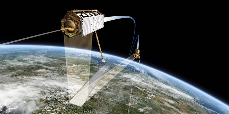
In the radar sector, Germany’s TerraSAR-X (2007) and TanDEM-X (2010) satellites operated in a close bistatic formation – at separations of only a few hundred meters – using Synthetic Aperture Radar to image through persistent cloud cover and overcome traditional atmospheric distortions. Their precision formation-flying enabled a systematic global mapping campaign that ultimately produced the high-precision WorldDEM. This active-sensor capability drastically advanced global topographic measurement, providing researchers in the field with baselines to measure tectonic deformation, track ice sheet mass balance, and monitor rapid environmental shifts across dynamic landscapes. This period also saw the conclusion of ICESat-1 (GLAS), establishing early global baselines for spaceborne laser altimetry, while airborne Light Detection and Ranging (LiDAR) became the industry standard for regional terrain and canopy modeling.
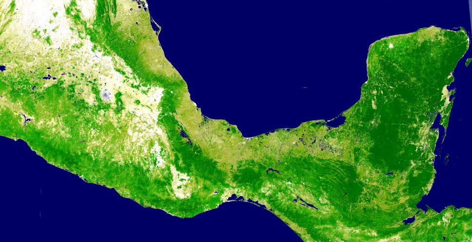
Concurrently, a major shift toward open-access data policies and cloud-based planetary analytics reshaped the domain. While international bodies such as the Group on Earth Observations (GEO) advocated coordinated environmental data sharing, the US government’s 2008 policy making the Landsat archive freely accessible provided a major catalyst. To consolidate this record, the USGS launched the Landsat Global Archive Consolidation (LGAC) initiative in 2010 to recover and centralize historic imagery. Against this backdrop, Google debuted Google Earth Engine at COP16 in December 2010, enabling large-scale analysis of time-series satellite imagery via cloud computing and accelerating the transition toward systematic, long-term environmental monitoring.



IGARSS: Supporting the Global Technical Community
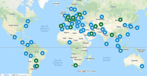
From 2007-2012, IGARSS continued to provide valuable opportunities for participants to meet, share research, explore partnerships, and collaborate to help expand technology and applications in global remote sensing. IGARSS 2007 was held in Barcelona, Spain, followed by IGARSS 2008 in Boston, US. The symposium then moved to Cape Town, South Africa, in 2009, Honolulu, US, in 2010, Vancouver, Canada, in 2011, and Munich, Germany, in 2012. This sequence placed the annual conference in many different parts of the world, providing broad global accessibility.
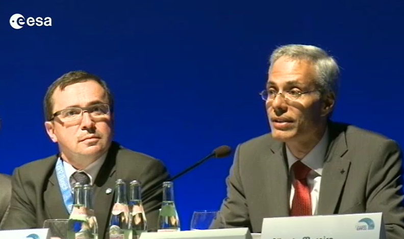
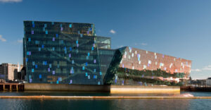
The global reach of IGARSS was especially clear in 2012. Held under the theme “Remote Sensing for a Dynamic Earth,” the Munich, Germany symposium included plenary and technical sessions, interactive poster sessions, awards activities, and meetings for technical committees, Chapters, young professionals, and women in geoscience and remote sensing. A Women in Geoscience and Remote Sensing Luncheon was introduced at the conference, with plans to continue similar activities at future symposia. As part of his year end summary, GRSS President Dr. Jon Atli Benediktsson noted that “2012 was a truly special year for the GRSS because the society celebrated its 50th anniversary at IGARSS 2012 in Munich. The location for the celebration was outstanding since IGARSS was previously held in Munich thirty years ago, and IGARSS 2012 was the largest IGARSS ever, with over 2700 delegates and more than 2500 papers presented.” IGARSS 2012 was a great example of the role GRSS plays in connecting technical research with professional development and international community-building.
Technical Committee Support
During the 2007 to 2012 era, the technical committees of the IEEE Geoscience and Remote Sensing Society (GRSS) supported the broader remote sensing community as it focused on optimizing the deployment of complex, multi-satellite observation constellations and resolving the challenges of increased data. Five legacy committees served GRSS at the time, though some operated under names that would evolve over time.
The Data Archiving and Distribution Technical Committee, later renamed Earth Science Informatics Technical Committee, supported members concerned with data archiving, distribution, and the organization and sharing of Earth science data. The Data Fusion Technical Committee, later renamed Image Analysis and Data Fusion Technical Committee, provided a forum for members working to advance methods and algorithms for combining disparate datasets, such as combining radar and optical imagery to improve urban and environmental mapping. For members working with hyperspectral data, the International Spaceborne Imaging Spectroscopy Technical Committee supported the exchange of knowledge on spaceborne imaging spectroscopy and its geoscience applications; it was later renamed Geoscience Spaceborne Imaging Spectroscopy Technical Committee. The Frequency Allocations in Remote Sensing Technical Committee supported members concerned with frequency sharing and interference between remote sensing and other uses of the radio spectrum. The Instrumentation and Future Technologies Technical Committee supported GRSS members working to the state of remote sensing instrumentation, identify emerging instrument concepts and technology trends, and recognize enabling technologies for future instruments. The Instrumentation and Future Technologies (IFT) Technical Committee of the Geoscience and Remote Sensing Society served members by fostering international cooperation in advancing the state-of-the-art in geoscience remote sensing instrumentation and technologies.
A Growing Publications Portfolio
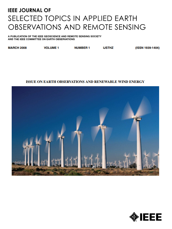
At the start of the 2007-2012 period, the GRSS communications portfolio was driven by its established core publications: the IEEE Transactions on Geoscience and Remote Sensing (TGRS), the IEEE Geoscience and Remote Sensing Letters (GRSL), and the IEEE Geoscience and Remote Sensing Newsletter. But GRSS recognized a gap in its publication portfolio. Remote sensing was evolving into a practical tool for addressing real-world problems at a global scale. Initiatives such as Global Earth Observation System of Systems (GEOSS) were encouraging international coordination and data sharing, while new satellite missions and sensors were generating larger and more diverse datasets. Together, these developments created growing expectations that remote sensing should deliver actionable information as well as technical innovation. To bridge the gap, IEEE GRSS launched the Journal of Selected Topics in Applied Earth Observations and Remote Sensing (J-STARS) in March 2008. “The purpose was not to compete with existing journals, but to complement them by focusing on Earth observation applications and applied remote sensing research,” explains Professor Peifeng Ma, current J-STARS Editor in Chief (The Chinese University of Hong Kong). Another goal of the new Journal was to publish very quickly so that topics were timely and reflected the latest research and applications.
As the volume of global submissions and digital indexing on platforms like the IEEE Xplore Digital Library surged, managing these expanding assets required more focus. To streamline oversight, in 2010 the GRSS Administrative Committee (AdCom) created the dedicated position of Vice President for Publications. Dr. Wooil M. Moon (University of Manitoba) was appointed to oversee the governance of existing and future journals as well as symposia publications. In the December 2011 IEEE Geoscience and Remote Sensing Society Newsletter, GRSS President Dr. Jon Atli Benediktsson weighed in on the recent growth of GRSS publications: “Our three journal publications, TGRS, GRSL and J-STARS, continue to be very successful in terms of quality, timeliness and relevance for the remote sensing community,” he noted. “The submission rate has increased for all publications. Consequently, GRSL expanded to six issues this year. At the beginning of the year, Prof. Jocelyn Chanussot started his tenure as the new Editor of J-STARS. Under his leadership, J-STARS has done extremely well. The submission rate for J-STARS has tripled in 2011. Consequently, J-STARS will expand to 6 issues per year in 2012.”
Awards and Recognition
Between 2007 and 2012, GRSS continued to present annual awards to honor technical achievements, service, education, and exceptional research publications. By this time, several awards were long-standing, as evidenced by the GRSS historical timeline of awards (www.grss-ieee.org/about/history/ grss-past-awards/). Three new awards were added in this era, as continued evidence of how GRSS honors and recognizes members and volunteers.
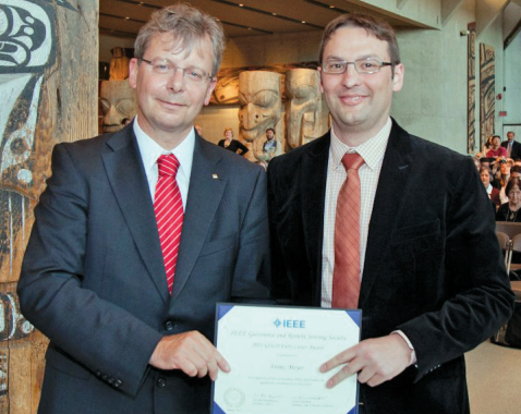
In 2011, the Gold Early Career Award was initiated to promote, recognize and support young GRSS scientists and engineers who demonstrated outstanding ability and promise for significant contributions in the future. Selection factors included quality, significance and impact of contributions, papers published in archival journals, papers presented at conferences and symposia, patents, demonstration of leadership, and advancement of the profession. The 2011 GOLD Early Career Award was presented to Franz Meyer in recognition of “his outstanding ability and promise for significant contributions in the future.” At the time of the award, Meyer was Research Assistant Professor Radar Remote Sensing at the Geophysical Institute, University of Alaska Fairbanks, where his work included studies of ionospheric and tropospheric effects on SAR and InSAR, new methods of SAR Interferometry processing, SAR Interferometry applications, SAR processing, and SAR data quality analysis…he would go on to receive the IEEE GRSS Education Award in 2024.
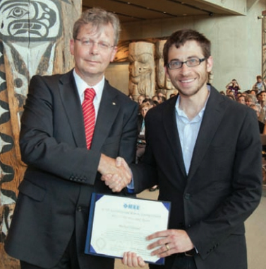
The J-STARS Prize Paper Award was also awarded for the first time in 2011, to recognize an author(s) who published an exceptional paper in the IEEE Journal of Selected Topics in Applied Earth Observations and Remote Sensing during the calendar year. The 2011 J-STARS Prize Paper Award was presented to Michael Durand (The Ohio State University), Ernesto Rodríguez (Jet Propulsion Laboratory), Douglas E. Alsdorf (The Ohio State University), and Mark Trigg (Flinders University, Australia) for their paper, “Estimating River Depth From Remote Sensing Swath Interferometry Measurements of River Height, Slope, and Width,” published in the IEEE Journal of Selected Topics in Applied Earth Observations and Remote Sensing, Vol. 3, No. 1, pp. 20–31, March 2010.
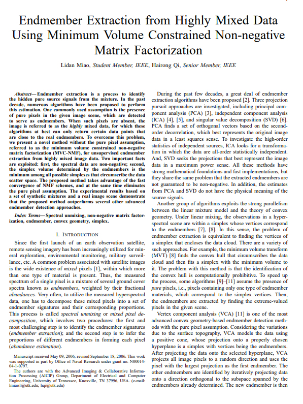
And, in 2012, the Highest Impact Paper Award (HIPA) was first awarded to researchers Lidan Miao (Microsoft) and Hairong Qi (University of Tennessee, Knoxville). The award recognized the author(s) who had published during the prior five years in an IEEE GRSS Journal the scientific paper that has received the highest number of citations and impact over those years as measured by the Thomson Reuters Web of Science citation index. The two were honored for their influential paper, “Endmember extraction from highly mixed data using minimum volume constrained non-negative matrix factorization,” which was published in IEEE Transactions on Geoscience and Remote Sensing (Volume: 45, Issue: 3, March 2007). Their work introduced an innovative framework to identify pure materials in highly mixed hyperspectral satellite data, which remains a foundational technique in remote sensing image processing.
Building New Connections With Data Fusion
The years 2007-2012 saw GRSS continue to support events and activities that encourage collaboration among members and beyond. A perfect example is the IEEE GRSS Data Fusion Contest that was initiated in 2006 by the Image Analysis and Data Fusion Technical Committee to foster interdisciplinary collaboration, promote best practices, and provide standardized evaluation datasets to test innovative machine learning and computer vision algorithms. It encourages members and non-members to participate, and was started because the committee recognized that integrating data across heterogeneous sensor modalities and varying scales was absolutely vital to unlocking the true potential of Earth observation data. The ultimate goal of the initiative is to advance geospatial artificial intelligence to solve complex remote sensing problems for social good.
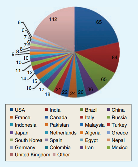
From 2006 to 2012, the contest featured a range of topics from foundational image processing to advanced multi-sensor urban evaluations. The inaugural 2006 contest focused on pansharpening algorithms. The scope broadened to include joint SAR and optical urban mapping (2007), very high-resolution hyperspectral image classification (2008), and multi-modal flood change detection (2009-2010). The contest explored optical multi-angular data exploitation in 2011 and a comprehensive multi-modal, multi-temporal fusion challenge in 2012 that successfully combined optical, SAR, and LiDAR datasets.
As a detailed example, in 2011, a set of WorldView-2 multi-angular images was provided by DigitalGlobe, composed of five Ortho Ready Standard multi-angular acquisitions, including both 16 bit panchromatic and multispectral 8-band images. The data were collected over Rio de Janeiro (Brazil) in January 2010 within a three-minute time frame with satellite elevation angles of 44.7°, 56.0°, and 81.4° in the forward direction, and 59.8° and 44.6° in the backward direction. Since there were a large variety of possible applications, each participant was allowed to decide a research topic to work on, exploring the most creative use of optical multi-angular information. By the end of May 2011, almost 800 researchers from 95 different countries subscribed to the Contest and downloaded the dataset, especially from the USA, India, and Brazil.
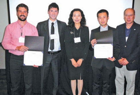
Several papers were submitted, showing numerous possibilities and variety of applications that optical multi-angular remote sensing can offer. The winners (ex-aequo) of the 2011 Data Fusion Contest were J. Syryczynski, G. Lemoine, C. Bielski, and D. Poli (European Commission, Joint Research Centre), for “BUILDING HEIGHT EXTRACTION FROM MULTIANGULAR WORLDVIEW-2 ORTHO READY IMAGES USING GPU-ACCELERATED TEMPLATE MATCHING,” L. Meng and J. P. Kerekes (Rochester Institute of Technology), for “OBJECT TRACKING USING HIGH RESOLUTION SATELLITE IMAGERY,” and F. Cavayas (University of Montreal), for “RADIOMETRIC STANDARDISATION OF MULTI-AtartttNGULAR HIGH RESOLUTION SATELLITE IMAGERY: PROBLEMS AND FEASIBILITY OF A GLOBAL SOLUTION.”
Celebrating the First Fifty Years
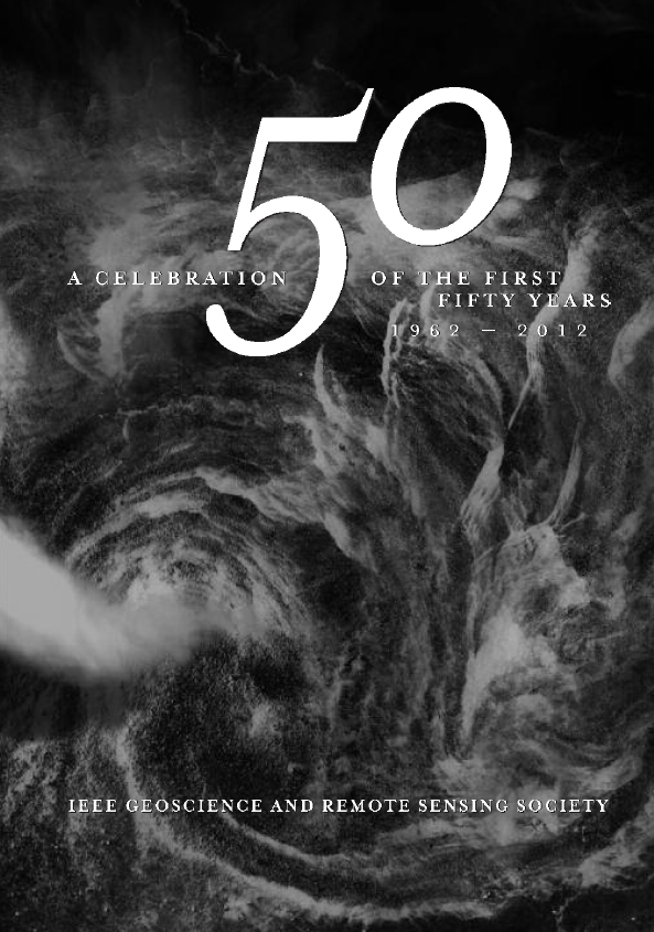
2012 marked the 50th anniversary of the IEEE Geoscience and Remote Sensing Society. The anniversary provided an opportunity to recognize the continuity of the Society’s mission while acknowledging the scale of the changes that had taken place over the years. The organization that entered its sixth decade was no longer defined primarily by a small group of engineers working in geoscience electronics. It had become a growing, global professional network supporting a wide range of remote-sensing technologies, scientific disciplines, applications, publications, and professional activities.
The anniversary was celebrated at IGARSS 2012 in Munich, Germany, where every registered attendee was presented with a copy of a specially commissioned hardcover historical book, “IEEE GRSS: A Celebration of the First 50 Years, 1962–2012.” The commemorative volume documented the history and growth of its activities through 2012. The publication represented the work of many volunteers who worked hard to document the rich history of the organization, and is still a source of interesting photos and information today.
Looking Forward From Fifty
The years 2007 through 2012 demonstrated how GRSS operated in a flexible way, responding to the changes in the field through expanded publications, chapters, awards, competitions, and member support. The Society’s 50th anniversary in 2012 represented both a historical milestone and a point of transition. The Society entered its sixth decade with a dedicated volunteer base, an involved and growing international community, an established publication and conference structure, and a continuing commitment to advancing geoscience and remote sensing through innovative professional activities.