





Written by: Madeleine Dawson, News Coordinator and Writer for IEEE GRSS
In this IEEE Geoscience and Remote Sensing Society Professional Member Spotlight, we feature Dr. Tao Chen, Associate Professor and Head of the Department of Geoinformatics at China University of Geosciences (Wuhan). His research bridges remote sensing, AI, and geoscience to advance the identification and monitoring of geological hazards, particularly landslides. Beyond his scientific contributions, Dr. Chen has demonstrated a strong commitment to the GRSS community through his leadership positions. As the Chair of the IEEE GRSS Wuhan Chapter and Chair-Elect of the GRSS China Chapter Chairs Council, he plays an active role in connecting researchers and supporting professional development. His journey reflects the importance of interdisciplinary innovation, mentorship, and international engagement in advancing Earth observation science. In this spotlight, Dr. Chen shares insights into his research, professional journey, and vision for the future of the GRSS community.
Can you introduce yourself and share a brief background about who you are and what you do?
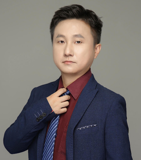 My name is Tao Chen, and I am currently an Associate Professor, Ph.D. supervisor, and Head of the Department of Geoinformatics, School of Geophysics and Geomatics, at China University of Geosciences (Wuhan).
My academic background is in photogrammetry and remote sensing, but over the years my research has increasingly moved toward the intersection of remote sensing, geoscience, and artificial intelligence. One question that has continued to interest me is quite practical: how can we make better use of the growing amount of Earth observation data to identify and monitor geological hazards, particularly landslides?
This has led my group to work on intelligent landslide recognition, susceptibility assessment, and dynamic monitoring of geological environments. I enjoy this field because it combines methodological research with real-world applications that can contribute to disaster prevention and risk reduction.
Besides research and teaching, professional service is also an important part of my academic life. I am an IEEE Senior Member, Chair-Elect of the IEEE GRSS China Chapter Chairs Council, Chair of the IEEE GRSS Wuhan Chapter, and an Associate Editor for IEEE JSTARS. I particularly enjoy working with students and young researchers and helping them become more connected with the international remote sensing community.
How long have you been a member? Tell us about your GRSS journey.
I joined IEEE in 2019, so I have been a member for about seven years. My involvement with GRSS has gradually grown from participating as a researcher to taking on more responsibilities within the community.
From 2021 to 2023, I served as Vice Chair of the IEEE GRSS Wuhan Chapter, and since 2024, I have served as Chapter Chair. During this period, I have participated every year in the GRSS China Chapter Chairs Meeting and the GRSS China Chapter Chairs Council Meeting. These experiences have allowed me to meet Chapter leaders from different parts of China and to think more broadly about how Chapters can work together.
In 2024, I initiated the IEEE GRSS China Chapter Strategical Planning Session and served as General Chair for its first two sessions. The idea was to create a regular opportunity for different Chapters to discuss longer-term development and collaboration rather than focusing only on individual activities.
Looking back, my GRSS journey has been a gradual transition from participating in the community to serving the community. I was elevated to IEEE Senior Member in 2021. After serving as Vice Chair of the Wuhan Chapter from 2021 to 2023, I became Chapter Chair in 2024. In 2025, I was elected as the 2026 Chair-Elect of the IEEE GRSS China Chapter Chairs Council. These experiences have given me opportunities to contribute not only at the local Chapter level, but also to broader communication and collaboration among GRSS Chapters in China.
What inspired you to join GRSS?
The initial reason was actually quite straightforward: my academic background is in photogrammetry and remote sensing, so GRSS was naturally very close to my research interests.
But after becoming more involved, I realized that what makes GRSS especially attractive is the diversity of the community. It brings together people working on sensors, algorithms, data processing, artificial intelligence, and many different Earth science applications.
This is particularly relevant to my own research. Geological hazards are complex problems. If we want to better understand and monitor landslides, for example, we need not only remote sensing imagery, but also geological knowledge, environmental information, and increasingly, artificial intelligence. GRSS provides a community where these different areas can come together.
Another thing that attracted me is its international character. Through publications, conferences, Chapter activities, and volunteer service, I have had opportunities to interact with researchers from different countries and different academic backgrounds. For me, that exchange of ideas is one of the most valuable aspects of GRSS.
How has GRSS contributed to your professional growth?
I think GRSS has influenced my professional growth in three main ways: as a researcher, as an editor, and as a volunteer.
As a researcher, GRSS journals and conferences have given my students and me important opportunities to present our work and learn from the broader remote sensing community. Publishing in journals such as IEEE Transactions on Geoscience and Remote Sensing and IEEE JSTARS has also helped us continuously improve the quality of our research.
As an Associate Editor for IEEE JSTARS, I have had the opportunity to see research from many areas beyond my own. That experience has broadened my understanding of the field and also influenced how I guide my students in conducting and presenting their research.
The third aspect is probably the most personal one. Serving first as Vice Chair and then as Chair of the Wuhan Chapter has changed my perspective from asking, “What can I gain from this community?” to also asking, “What can I contribute to this community?” The annual China Chapter Chairs meetings, my involvement with the China Chapter Chairs Council, and the IEEE GRSS China Chapter Strategic Planning Session have further strengthened this feeling.
So for me, GRSS has supported not only my research development, but also my growth as an editor, mentor, and volunteer.
What advice would you give to individuals considering joining the GRSS community?
My main advice would be: do not think of GRSS simply as a membership or as a place to publish papers. Think of it as a community, and try to participate in it.
For students and young researchers, attending a conference or a local Chapter activity can be a very good starting point. Present your own work, of course, but also take the opportunity to listen to people outside your immediate research area. Remote sensing is becoming increasingly interdisciplinary, and sometimes an idea from another field can completely change the way you think about your own problem.
I would also encourage young members to become involved in volunteer activities early. You do not have to wait until you are a senior researcher. My own experience with GRSS developed step by step—from participating in activities, to helping organize them, and eventually to taking on Chapter leadership responsibilities.
The more actively you participate, the more people you meet and the more perspectives you encounter. Over time, those connections can become an important part of your professional life.
Research Profile
What sector/theme/topics does your research focus on?
My research focuses mainly on intelligent remote sensing for geological environments and natural hazards, particularly landslides.
When I first started working in this area, remote sensing was already very useful for observing geological hazards over large areas. But as more satellite data became available, I became increasingly interested in a deeper question: having more data does not automatically mean that we understand the hazard better. Landslides are controlled by many interacting factors, including topography, geology, vegetation, rainfall, and human activities.
So my group has gradually developed our research around three connected topics: multi-factor sensing and analysis, intelligent landslide recognition, and dynamic monitoring of geological environments.
Artificial intelligence is an important tool in all three areas, but our goal is not simply to apply a new AI model to remote sensing images. What interests us more is how remote sensing observations, geoscientific information, and AI can work together.
Ultimately, we hope to move from simply “seeing” changes in remote sensing data toward better understanding, identifying, and monitoring geological hazards.
What key advancement(s) are you proud of in your work?
Rather than one particular algorithm, I am most proud of how our research has gradually connected several parts of the geological hazard problem.
For landslide recognition, we have explored how information from different feature levels in remote sensing imagery can be effectively integrated. One of our goals has been to achieve accurate recognition while keeping the models relatively efficient, because regional-scale geological hazard applications often involve very large datasets.
For susceptibility assessment, we have focused on the relationships among multiple geological and environmental factors. Instead of simply treating these factors as independent inputs, we have explored machine learning, deep learning, and graph-based approaches to better represent their interactions.
We have also worked on dynamic monitoring, particularly in complex environments such as mining areas. A model that works well in one region or at one time may not work equally well somewhere else, so improving adaptability across different spatial and temporal conditions is very important.
Over time, these efforts have developed into a framework that I often describe as multi-factor sensing, intelligent recognition, and dynamic monitoring. I am proud of this progression because it connects methodological advances in remote sensing and AI with practical geological hazard problems.
How does your work fit into IEEE GRSS society?
I think my research fits naturally within GRSS because it lies at the intersection of remote sensing methodology, artificial intelligence, and Earth science applications.
GRSS has a very broad scope. Some researchers focus on sensors and observation systems, others on algorithms and data processing, and others on applications. My work connects mainly the latter two: we develop methods for extracting and analyzing information from Earth observation data and then apply them to geological hazards and environmental monitoring.
Landslides are a good example of why this connection matters. Many landslide-prone areas are mountainous, widely distributed, and difficult to investigate continuously in the field. Satellite and other remote sensing technologies allow us to observe these areas repeatedly and over large spatial scales. At the same time, the increasing volume and diversity of Earth observation data create a strong need for more intelligent methods of analysis.
I therefore see our work as one example of how advances in remote sensing and AI can be connected with real-world geoscience problems. I also hope our research can help bring the geological hazard community and the broader GRSS community closer together.
Anything else to share? Conferences or events you are looking to attend?
One event I was particularly looking forward to was the inaugural IEEE Asia-Pacific Geoscience and Remote Sensing Symposium, AP-GARSS, which was held in Qingdao, China, this October.
I think the first AP-GARSS is especially meaningful because the Asia-Pacific region has a very large and active remote sensing community. It provides another important platform for researchers, students, and GRSS Chapters across the region to meet and exchange ideas.
As Chair of the IEEE GRSS Wuhan Chapter and Chair-Elect of the IEEE GRSS China Chapter Chairs Council, I looked forward to meeting colleagues from other Chapters and exploring opportunities for broader collaboration across China and the Asia-Pacific region. Over the past several years, I have been increasingly involved in communication and coordination among GRSS Chapters in China, including initiating the IEEE GRSS China Chapter Strategic Planning Session in 2024.
Looking ahead, I hope to continue participating in IGARSS, AP-GARSS, and other GRSS activities. More importantly, I hope to bring more students and young researchers into these activities and give them opportunities to build their own connections with the international community.
For me, that is one of the most rewarding parts of professional service: you begin by participating in a community yourself, and eventually you have the opportunity to help others become part of that community as well.
Do you know an IEEE GRSS professional member who deserves to be recognized? We invite you to submit a nomination by sending a brief message to ir_pub@grss-ieee.org with the subject: “Professional Member Spotlight.”
Not yet a member? Learn more about IEEE GRSS membership and join us today: GRSS Membership.