


Organization
The REACT Technical Committee encourages participation from all its members. The committee organization includes the Chair, the Co-Chair, Past Chair and Chair-Elect.
REACT Technical Committee Chair
 | Dr. M. Adnan Siddique |
REACT Technical Committee Co-Chair
 | Prof. Ryo Natsuaki The University of Tokyo Japan |
REACT Technical Committee Chair Past-Chair
 | Prof. Irena Hajnsek ETH Zurich / German Aerospace Center – DLR |
REACT Technical Committee Chair-Elect
 | Dr. Subit Chakrabarti |
Local Focus Areas
Urban Resilience
Focus Area Lead: Prof. Yifang Ban
KTH Royal Institute of Technology, Sweden
Focus Area co-Lead: Dr. Pooja Shah
University of Tasmania, Australia
With nearly 70% of the global population projected to live in cities by 2050, urban resilience is more critical than ever. As 2024 is set to be the warmest year on record, the accelerating impacts of climate change—rising sea levels, extreme weather, and intensifying urban heat—are becoming increasingly evident. Urban heat resilience, equity, and justice remain urgent concerns, as rising temperatures disproportionately impact cities, particularly marginalized communities.
Earth Observation (EO) and big data analytics provide powerful tools to map spatial patterns and temporal trends of urban heat islands, identify disparities, and support climate adaptation strategies. These insights enable planners and policymakers to develop equitable, nature-based solutions, ensuring cities are resilient, sustainable, and just. Beyond heat-related challenges, EO technologies can also address urban hazards such as air pollution, flooding, and ground subsidence, offering a comprehensive approach to urban resilience. This task group aims to facilitate the sharing of EO-based datasets, methods, tools, and best practices in urban resilience, fostering collaboration and innovation.
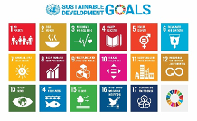
UN Sustainable Development Goals (SDGs) addressed are:
SDG 11: Sustainable Cities and Communities
SDG 13: Climate Action
SDG 10: Reduced Inequalities
Risks in High Mountain Asia
Focus Area Lead: Dr. Muhammad Adnan Siddique
Information Technology University of the Punjab, Pakistan
Focus Area co-Lead: Dr. Jakob Steiner
University of Graz, Austria
This focus area is dedicated to advancing and sharing scientific insights related to the environmental risks affecting High Mountain Asia (HMA). As the region with the largest concentration of ice outside the polar areas, HMA is under threat from climate change, with many of its glaciers retreating rapidly due to global warming. This accelerated glacial melting endangers ecosystems and communities, heightening the risk of hazards such as flash floods, landslides, debris flows, and rockfalls. Through the application of Geosciences and Remote Sensing, we can better understand these processes and model the key factors driving such hazards. Our goal is to bring together scientists and researchers from across disciplines to enhance knowledge and foster collaboration, contributing to a deeper understanding of the natural processes at work in HMA. This initiative within REACT aims to be a catalyst for collective efforts to address these growing challenges.
Flooding in Africa
Focus Area Lead: Dr. Subit Chakrabarti
Cloud to Street
Floods, which constitute around half of all extreme events, are increasing, exposing a larger population to a higher risk of loss of livelihood and property. Climate change is also increasing the severity of floods, which makes these losses catastrophic and threatens every SDG at local and regional scales. The impact of flooding on the African continent is massive because robust flood defenses and urban drainage systems are lacking in many cities that are built on floodplains, which amplifies the risk further. Remote sensing and EO can help mitigate the loss of lives and livelihood and increase adaptation to floods. Near-real-time maps of inundation allow first responders and disaster managers to prioritize aid to the most affected areas, flood-risk maps allow planners to build flood defenses for neighborhoods that are most at risk, and predictive models built using EO data can help aid agencies provide anticipatory financing to vulnerable communities. However, major technical challenges still remain in generating actionable insights and inundation maps from remotely sensed imagery, which can only be solved when remote sensing experts work with emergency managers and other end users directly.
Pacific Islands and Territories
Focus Area Lead: Dr. Anthony Milne
University of New South Wales
Although Pacific Island nations have had the least involvement in causing anthropogenic climate change, they will experience the most extreme consequences. Recently, climate change has compounded an already-vulnerable situation by increasing the frequency and intensity of extreme climatic events that pose a significant threat to the safety of people and communities. The cost of recovery from these events can be significant. Local retrieved information from remote sensing data will increase awareness and is providing a better understanding of the environmental processes. The task here is to educate the local inhabitants about the knowledge gained from remote sensing and to bring together experts’ knowledge worldwide to support them with quantitative information to inform and guide decisions in promoting sustainable management of both land and ocean environments.
Agriculture and Food Security
Focus Area Lead: Dr. Avik Bhattacharya
Indian Institute of Technology Bombay
Focus Area co-Lead: Dr. Praveen Pankajakshan
Cropin AI Lab
Focus Area co-Lead: Dr. Dipankar Mandal
Indian Institute of Technology Guwahati
Global food security is a part of the objectives of the UN’s SDG and can be achieved through sustainable agricultural and regenerative practices, reduced food losses and waste, improved nutrient content, and assured zero hunger. With global warming, escalating conflicts, spiraling climatic crises, and economic downturns in recent years, global agricultural monitoring for sustainable food production and regional food security are critical objectives to address at the moment. One of the essential components of this is optimizing agricultural input resources including water usage, soil nutrient, pests and diseases, availability of clean, energy and labour. However, the high variability in cropping systems and agroecological zones makes agricultural production extremely diverse. For instance, crop monitoring, forecasting, and mechanization are highly site-specific due to variability in crop traits, pathogen pressures, environmental conditions, input availability and management strategies, making technological generalization very challenging. The volume of EO data used for near-real-time monitoring along with cloud-based processing and machine learning (ML) has recently enhanced scientific capacity and methods for investigating land and water resource management. Several efforts were made within scientific communities, commercial organizations, and national agencies to develop EO data products and ML methodologies that aid in monitoring biophysical (crop condition anomalies, planting acreage) and socio-political risk factors related to agricultural production and food security. End users with limited background in EO, would like to have analysis-ready data sets to assist them in continuous monitoring and impact analysis of climate change or interventions. These are critical needs across both developed and developing economies. We will initiate processes to make EO data in the form of analysis-ready and state-of-the-art methodologies for end-users towards the SDG.
News
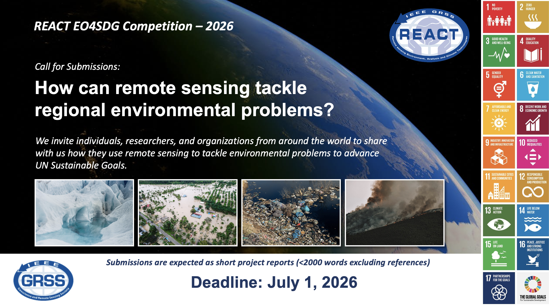
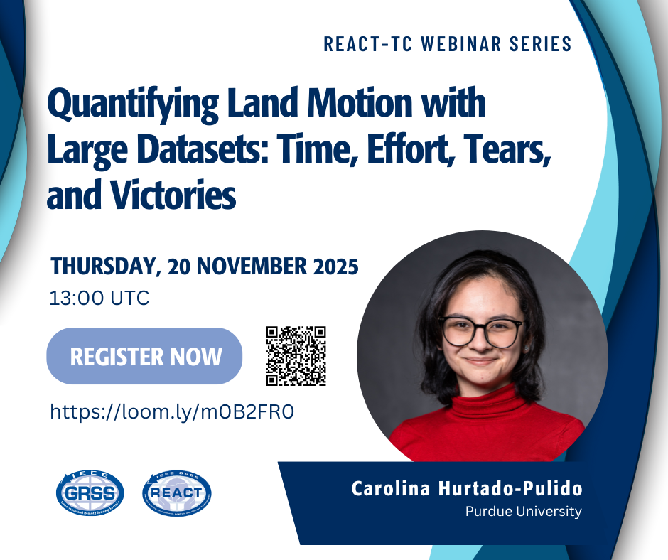
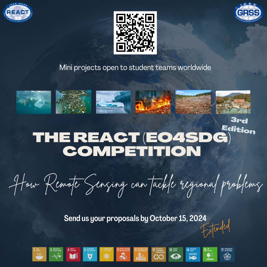
Call for Submissions – REACT EO4SDG Competition – 2026
The EO4SDG competition, organized by IEEE GRSS’s REACT Technical Committee, invites practitioners, researchers, students, and organizations worldwide to showcase how remote sensing technologies are being used to address local environmental challenges — from disaster response to resource management — in support of the UN Sustainable Development Goals. Submit your innovative ideas and help shape a more sustainable future. (Deadline: July 1, 2026).
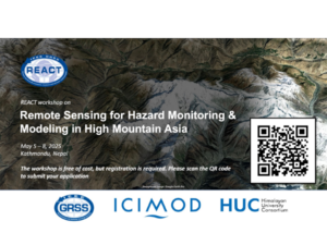
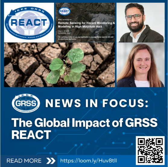
Workshop on Remote Sensing for Hazard Monitoring & Modeling in High Mountain Asia
The IEEE Geoscience & Remote Sensing Society (GRSS), in collaboration with the Regional Information System (RIS) – International Centre for Integrated Mountain Development (ICIMOD), and the Himalayan University Consortium (HUC), is organizing a four-day workshop focused on remote sensing for hazard monitoring and modeling in High Mountain Asia (HMA). This event is designed for early-stage researchers and graduate students in the fields of geosciences and remote sensing. (Monday – Thursday, May 5 – 8, 2025).
Special Tutorial at the 9th Asia-Pacific Conference on Synthetic Aperture Radar (ASPAR 2025)
GRSS REACT is organizing a special tutorial at the 9th Asia-Pacific Conference on Synthetic Aperture Radar (APSAR 2025), scheduled in October 2025, in Matsue, Shimane, Japan.

REACT is featured by GEO
The GRSS REACT technical committee has recently been featured by the Group on Earth Observations (GEO) – EO4SDG, recognizing REACT’s contribution in promoting the achievement of SGD 13 (by enhancing access to correct interpretations of climate risks). The feature blog is available here.
EO4SDG organizes and realizes the potential of Earth observations and geospatial information to advance the United Nations 2030 agenda and enable societal benefits through achievement of the Sustainable Development Goals. For more information about the EO4SDG initiative, please visit: eo4sdg.org/.
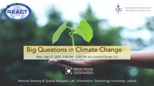
Big Questions in Climate Change: A Series of Expert Panel Discussions
IEEE GRSS REACT technical committee organized a series of expert panel discussions in Lahore, Pakistan, focusing on the critical question: How can geosciences and remote sensing facilitate informed and sustainable climate action? Pakistan ranks high among the countries most vulnerable to the impacts of climate change. Each discussion brought together 4-5 experts from the fields of remote sensing technologies, business leaders and socio-economists working on the mitigation of climate change impacts in Pakistan. Several students and members of the general public also attended these sessions. The key takeaways from these panel discussions – apart from a clear realization that remote sensing technologies can play a powerful role by enabling the policymakers to understand the local impacts and make informed decisions – include I) the need to have more data sharing agreements, particularly with public authorities, II) establish standards for data and analyses, and III) increase the momentum of North-South research collaborations. A bottom-up approach is suggested, with all stakeholders being urged to be more proactive and deliver on quantifiable outcomes (such as successful GRS research projects, development of climate-centric EO products for the local market, and socio-economic modeling for evaluating the progress towards sustainable development goals).

Pakistan Coastal Ecosystem – Mapping and Monitoring
Webinar Speaker: Dr. Hammad Gilani
International Water Management Institute (IWMI) Pakistan

The REACT EO4SDG Mini Projects
The mini projects for Sustainable Development Goals competition is an initiative of the IEEE Geoscience and Remote Sensing Societies Technical Committee REACT (Remote Sensing Environment, Analysis and Climate Technologies) to support science and to motivate local students to work together on a specific topic related to Earth Observation and Sustainable Development Goals (EO4SDG). The focus should be on local regional problems and how remote sensing can help to identify and quantify the environmental/societal impact of a changing Earth. Learn more here.
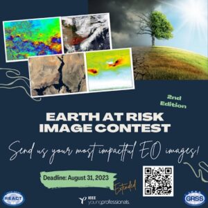
“Earth at Risk” Image Contest
The IEEE GRSS Young Professionals and REACT Technical Committee (Remote sensing Environment, Analysis and Climate Technologies) are pleased to announce the image contest “Earth at Risk” organized in conjunction with the mini-projects for sustainable development goals competition.
This contest aims to raise awareness of nature and climate crises and to demonstrate the power of Earth Observation (EO) data in helping us better understand the environmental changes on Earth and find solutions to protect our planet. Learn more here.
Activities
 | Webinars |
 | Contests and Challenges |
 | Schools |
 | Workshop |
 | Community-contributed sessions at IGARSS |
Past Activities
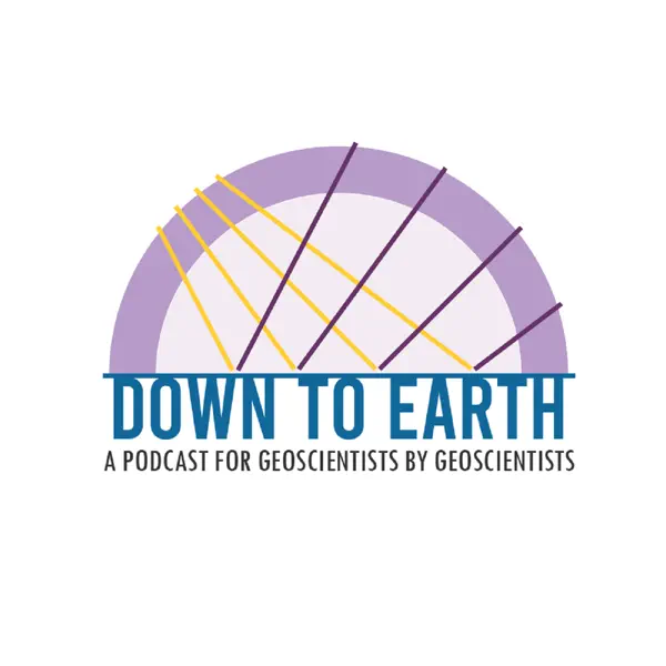
- Down to Earth Podcast: Episode 2 features Dr. Beth Tellman who talks about using remote sensing to combat climate change.
- Webinar on Using Remote Sensing to Promote Sustainability
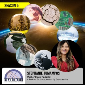
Down to Earth Season 5: A Podcast for Geoscientists by Geoscientist related to pressing challenges of climate change
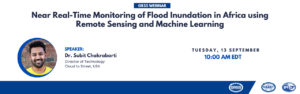
Near Real-Time Monitoring of Flood Inundation in Africa using Remote Sensing and Machine Learning
In recent years, there has been an uptick in the frequency of climate disasters across the globe. African countries are generally poorly equipped to recover and adapt to climate-related shocks, most notably, disastrous flooding. According to Africa’s Pulse publication (Zeufack et al., 2021), within the last decade, storms have quadrupled in frequency while floods have also increased tenfold when compared to the 1970s. Since 2015, Cloud to Street has supported humanitarian organizations and governments of 28 countries across Africa with a near real-time multi-sensor flood monitoring system. In this talk, this system, utilizing Landsat and Sentinel constellations coupled with our deep learning based CNN flood detection algorithm, will be demonstrated. We will also show how this flood monitoring system provides the necessary historical data to assess and mitigate risk, improves situational awareness, and informs disaster response and recovery with medium to high resolution satellite observations.
The Technical Committee REACT of the IEEE Geoscience and Remote Sensing Society are proud to announce the winners of our 2022 EO4SDG contest.
New REACT (EO4SDG) Competition
The mini projects for Sustainable Development Goals competition is an initiative of the IEEE Geoscience and Remote Sensing Societies Technical Committee REACT (Remote sensing Environment, Analysis and Climate Technologies) to support science and to motivate local students to work together on a specific topic related to Earth Observation and Sustainable Development Goals (EO4SDG).
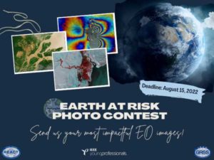
The IEEE GRSS Young Professionals and REACT Technical Committee (Remote sensing Environment, Analysis and Climate Technologies) are pleased to announce the photo contest “Earth at Risk” organized in conjunction with the mini-projects for sustainable development goals competition.
Sustainable Series
The next webinar in the Sustainability series is on December 7th at 12 Noon EST on using remote sensing to detect Methane emissions. Sign up here.

IGARSS 2022 Invited Session
An invited session is planned for IGARSS 2022 in Kuala Lumpur, Malaysia taking place 17-22 July, 2022. The session is open to all that like to share their recent results on remote sensing towards sustainable development goals and is entitled as ‘Advances in remote sensing towards sustainable development goals’.
Contact
The REACT TC is open for a wide range of people with different expertise and background and working in different application areas. We are happy if you provide feedback, suggestions, or ideas for future activities.
You can engage with us by contacting the Committee Chairs by email react_chairs@grss-ieee.org.