


Organization
The MIRS Technical Committee encourages participation from all its members. The committee organization includes the Chair and two Co-Chairs.
MIRS Technical Committee Chair
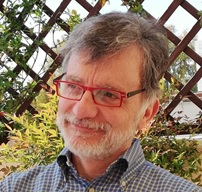 | Nazzareno Pierdicca Sapienza University of Rome Italy e-mail: nazzareno.pierdicca@uniroma1.it |
MIRS Technical Committee Co-Chair
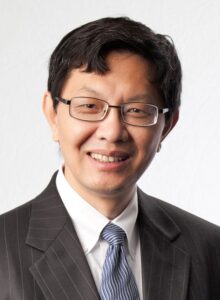 | Prof. Ping Yang Texas A&M University |
MIRS Technical Committee Co-Chair
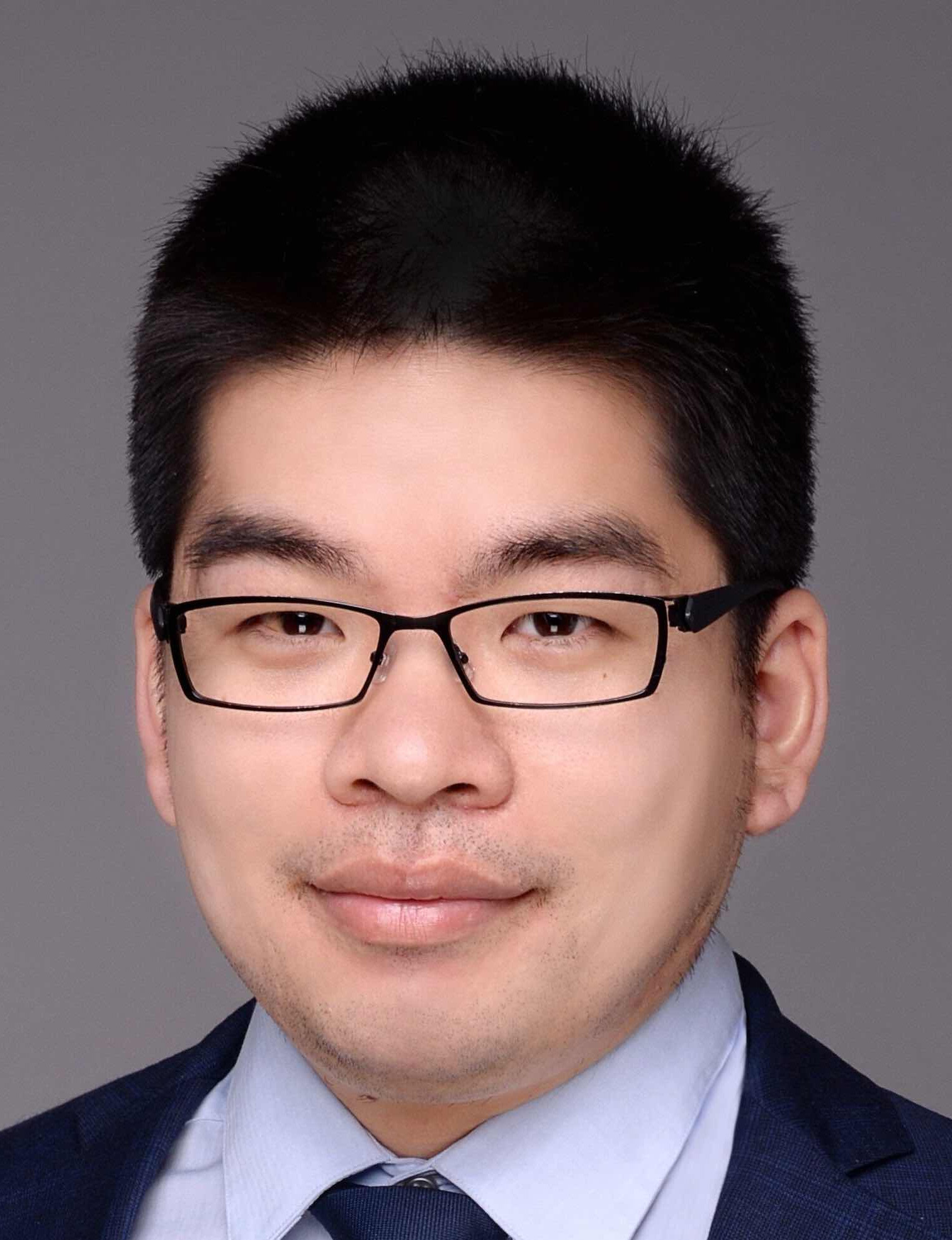 | Tianlin Wang
|
Working Group on GNSS-R
WG GNSS-R Lead
 | Dr. Davide Comite Sapienza University of Rome Italy |
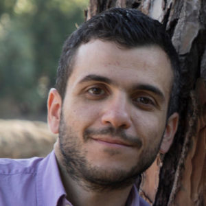
WG GNSS-R Co-Lead
 | Dr. James Campbell University of Southern California USA |
Call for Models
If you have any models or codes that you wish to share with the community, please send an email to Nazzareno Pierdicca (nazzareno.pierdicca@uniroma1.it).
Community-Contributed Sessions at IGARSS 2024
CCS.48: GNSS-R Modeling: Land and Ocean
CCS.49: GNSS-R Modeling: Physics-informed machine-learning retrieval
CCS.71: Modeling in Remote Sensing
IEEE GRSS MicrowAve MonItoring of WATer with Applications (MAMI WATA) Workshop
Date: November 30-December 1, 2023
Venue:
California Institute of Technology
1200 E California Blvd, Pasadena, CA 91125
Organizer: IEEE GRSS MIRS Technical Committee
Contact: mamiwataworkshop@gmail.com, mirs_chairs@grss-ieee.org
Introduction
Existing remote-sensing methods for mapping global inland water bodies include optical, hyperspectral, and microwave techniques such as SAR, radar altimetry, radiometry, and GNSS reflectometry, which have been successfully utilized by different remote sensing communities. This workshop will provide a forum to discuss/assess each technique individually as well as explore a joint multi-sensor performance, and evaluate preliminary strategies for data fusion and existing fused product exploitation. It will foster cooperation on models of heterogeneous scenes, as well as applications of satellite data to hydrology and climate studies. The workshop will help the research community better utilize the existing dataset such as CYGNSS and Sentinel, and prepare for opportunities arising with future satellite missions, e.g. NISAR, ROSE-L, HydroGNSS, and others.
The workshop will consist of keynote presentations on the three themes listed below, including in the form of panels, and discussions.
Theme 1 – How does any individual remote sensing technique perform? Should cover the different stakeholders’ concerns. Consider data type, availability, spatial coverage, temporal repeat. Missions in operation as well as in development are appropriate.
Theme 2 – Techniques intercomparison and complementarities. Here the focus is on studies that have already produced results and preliminary assessments, discuss algorithms using real data and simulations. Opportunities based on operational and soon-to-be-launched missions, etc. Should include cal/val needs and in-situ campaigns. Could have a component on models.
Theme 3 – Emerging synergies and strategies for future data types. Here the focus is on leading edge techniques for data fusion, new mission opportunities now in formulation. What investments, collaborations might be helpful?
Remote access to the workshop will be arranged. A limited number of travel grants will be available to students and YPs, assigned based on order of request and registration.
To encourage the next generation of researchers to get involved and showcase the contributions of the younger members of the community, presentation made by students and early career researchers are highly encouraged, associated with prizes for “best young researcher presentation” to encourage involvement.
Registration
Registration is required before September 15, 2023. There is no registration fee.
Please sign up here.
Plan Your Visit
www.caltech.edu/about/visit/plan-your-visit
Technical Program
Please find the final technical program here.
Status
The workshop has been successfully held at Caltech. A detailed report is currently being prepared for the IEEE Geoscience and Remote Sensing Magazine. The presentations will be published upon approval from the authors.
Models
Links to some models that involve modeling of remotely sensed data using physics-based modeling of environments on the Earth.
If you know of models that should be included here, please email Sharmila Padmanabhan.
PolSARPro
The Polarimetric SAR Data Processing and Educational Tool aims to facilitate the accessibility and exploitation of multi-polarized SAR datasets.
PROSAIL
The combined PROSPECT leaf optical properties model and SAIL canopy bidirectional reflectance model, also referred to as PROSAIL, has been used for about sixteen years to study plant canopy spectral and directional reflectance in the solar domain. PROSAIL has also been used to develop new methods for the retrieval of vegetation biophysical properties. It links the spectral variation of canopy reflectance, which is mainly related to leaf biochemical contents, with its directional variation, which is primarily related to canopy architecture and soil/vegetation contrast. This link is key to simultaneous estimation of canopy biophysical/structural variables for applications in agriculture, plant physiology, and ecology at different scales. PROSAIL has become one of the most popular radiative transfer tools due to its ease of use, general robustness, and consistent validation by lab/field/space experiments over the years.
An ArcGIS toolbox with 49 individual models was generated in the ModelBuilder for automated land surface temperature (LST) retrieval using different retrieval algorithms and land surface emissivity (LSE) models. Mono Window Algorithm (MWA), Radiative Transfer Equation (RTE) method, Single Channel Algorithm (SCA), and Split Window Algorithm (SWA) are implemented as LST retrieval methods to process data of Landsat missions (Landsat 5, 7, and 8). Different Normalized Difference Vegetation Index (NDVI)-based LSE models are used. The toolbox consists of three main parts with reference to the three Landsat missions, and each mission was categorized considering different LSE models for LST retrieval methods. Furthermore, if users have their own LSE image, they can also use this toolbox by selecting the external LSE model for each Landsat mission. The full explanation of the Toolbox can be found in the open-access paper:
Sekertekin, A.; Bonafoni, S., “Land Surface Temperature Retrieval from Landsat 5, 7, and 8 over Rural Areas: Assessment of Different Retrieval Algorithms and Emissivity Models and Toolbox Implementation.” Remote Sens. 2020, 12, 294, doi.org/10.3390/rs12020294
DART
The Discrete Anisotropic Radiative Transfer Model: An efficient model for environmental studies from space. Satellite and airborne optical sensors are increasingly used by scientists, policymakers, and managers for studying and managing forests, agriculture crops, and urban areas. Their data acquired with given instrumental specifications (spectral resolution, viewing direction, sensor field-of-view, etc.) and for a specific experimental configuration (surface and atmosphere conditions, sun direction, etc.) are commonly translated into qualitative and quantitative Earth surface parameters. However, atmosphere properties and Earth surface 3D architecture often confound their interpretation. Radiative transfer models capable of simulating the Earth and atmosphere complexity are, therefore, ideal tools for linking remotely sensed data to the surface parameters. Still, many existing models are oversimplifying the Earth-atmosphere system interactions and their parameterization of sensor specifications is often neglected or poorly considered. The Discrete Anisotropic Radiative Transfer (DART) model is one of the most comprehensive physically based 3D models simulating the Earth-atmosphere radiation interaction from visible to thermal infrared wavelengths. It models optical signals at the entrance of imaging radiometers and laser scanners on board of satellites and airplanes, as well as the 3D radiative budget, of urban and natural landscapes for any experimental configuration and instrumental specification.
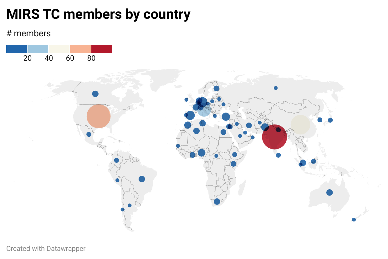
Current membership (as of January 2024)
Contact
You can contact the Committee Chairs by email at mirs_chairs@grss-ieee.org.
Membership in the MIRS Technical Committee is open to anyone interested in issues related to modeling for remote sensing. IEEE Geoscience and Remote Society membership is encouraged, but not required to join the MIRS Technical Committee. Join the MIRS Technical Committee!


