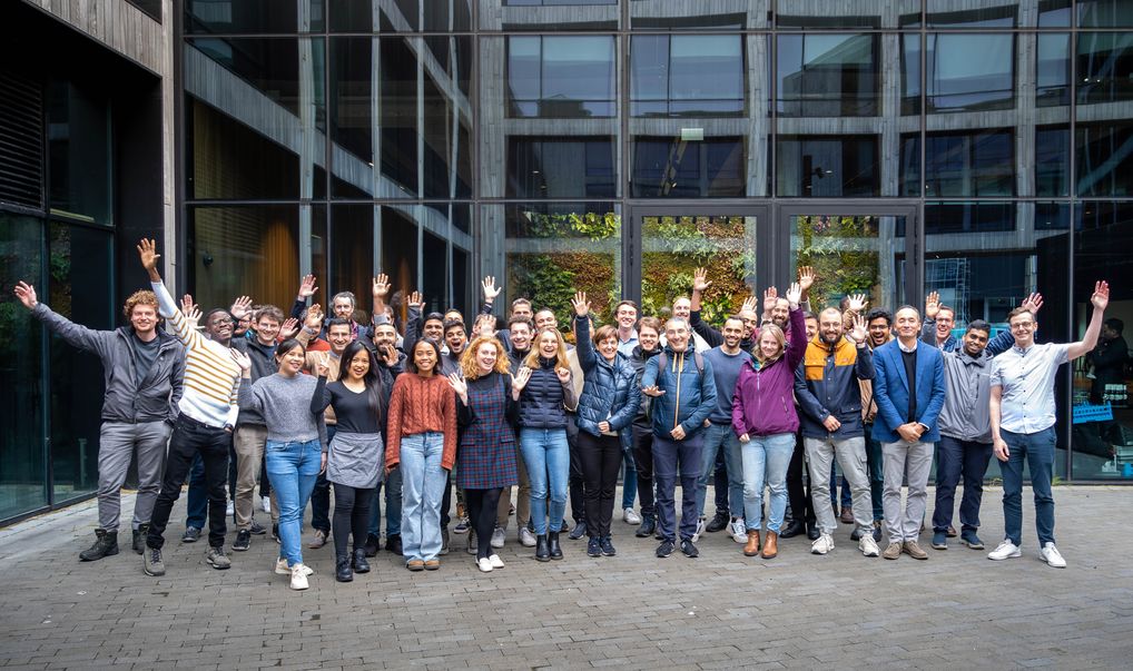
 Welcome to the summer school organized by the High-Performance and Disruptive Computing in Remote Sensing (HDCRS) Working Group. HDCRS is part of the IEEE Geoscience and Remote Sensing Society (GRSS), in particular of the Earth Science Informatics (ESI) Technical Committee.
This school is the perfect venue to network with students and young professionals, as well as senior researcher and professors who are world-renowned leaders in the field of remote sensing and work on interdisciplinary research with high performance computing, cloud computing, quantum computing and parallel programming models with specialized hardware technologies.
Opening Introduction
Welcome at the University of Iceland and opening of the summer school with an introduction to the IEEE Geoscience and Remote Sensing Society (GRSS).
The Instructors
Prof. Jón Atli Benediktsson
Biography
Jón Atli Benediktsson received the Cand.Sci. degree in electrical engineering from the University of Iceland, Reykjavik, in 1984, and the M.S.E.E. and Ph.D. degrees in electrical engineering from Purdue University, West Lafayette, IN, in 1987 and 1990, respectively. Since July 1, 2015 he is the President and Rector of the University of Iceland. From 2009 to 2015 he was the Pro Rector of Science and Academic Affairs and Professor of Electrical and Computer Engineering at the University of Iceland. His research interests are in remote sensing, biomedical analysis of signals, pattern recognition, image processing, and signal processing, and he has published extensively in those fields. Prof. Benediktsson is a Highly Cited Researcher (Clarivate Analysis, 2018-2020). He was the 2011-2012 President of the IEEE Geoscience and Remote Sensing Society (GRSS) and was on the GRSS AdCom from 2000-2014. He was Editor in Chief of the IEEE Transactions on Geoscience and Remote Sensing (TGRS) from 2003 to 2008 and has served as Associate Editor of TGRS since 1999.
Lecture content
This presentation will introduce the working group “High-performance and Disruptive Computing in Remote Sensing” (HDCRS) of the GRSS Earth Science Informatics Technical Committee (ESI TC). HDCRS is the organizer of this summer school and its main objective is to connect a community of interdisciplinary researchers in remote sensing who are specialized on high-performance and distributed computing, disruptive computing (e.g., quantum computing) and parallel programming models with specialized hardware (e.g., GPUs, FPGAs). The activities of the working group include educational events, special sessions and tutorials at conferences and publication activities, which will be presented.
Get slides
The Instructors
Prof. Dora Blanco Heras
Biography
Dora B. Heras is an associate professor in the Department of Electronics and Computer Engineering at the University of Santiago de Compostela (Spain). She received a MS in Physics in 1993 and was awarded a PhD cum laude from this university. In the period from 2005 to 2010 she was appointed as the head of the Sustainable Development Office at this university. Since 2008 she is also with the research centre CiTIUS (Centro de Investigación en Tecnoloxías Intelixentes) where she leads the hyperspectral remote sensing computing line and has received the accreditation as full professor in 2020. He is also co-chair of the High-Performance and Disruptive Computing in Remote Sensing (HDCRS) Working Group of the IEEE GRSS ESI Technical Committee.
Her research contributions cover a range of topics in the combined fields of image processing, remote sensing, machine learning and high performance computing. In particular, in the last ten years her research has been framed in the line of high performance computing and its application to remote sensing. She has participated in research projects funded by Spanish and European institutions, and R&D agreements. She has served as program committee, guest editor and reviewer in several conferences, in particular, the Euromicro 2021 Parallel and Distributed Conference, and serves as reviewer for different top-ranked journals. She is also a member of the Euro-Par conference Steering Committee since 2018 and has acted as co-chair of the co-located workshops for all the editions since 2017.
Dr. Gabriele Cavallaro
Biography
Gabriele Cavallaro received the B.Sc. and M.Sc. degrees in telecommunications engineering from the University of Trento, Italy, in 2011 and 2013, respectively, and the Ph.D. degree in electrical and computer engineering from the University of Iceland, Iceland, in 2016. He is currently the head of the ‘‘AI and ML for Remote Sensing’’ Simulation and Data Lab at the Jülich Supercomputing Centre, Germany. He is also the chair of the High-Performance and Disruptive Computing in Remote Sensing (HDCRS) Working Group of the IEEE GRSS ESI Technical Committee.
He was the recipient of the IEEE GRSS Third Prize in the Student Paper Competition of the IEEE International Geoscience and Remote Sensing Symposium (IGARSS) 2015 (Milan – Italy). His research interests cover remote sensing data processing with parallel machine learning algorithms that scale on high performance and distributed systems. He serves on the scientific committees of several international conferences and he is a referee for numerous international journals. Since 2019 he gives lectures on scalable machine learning for remote sensing big data at the Institute of Geodesy and Geoinformation, University of Bonn, Germany.
Lecture content
Geospatial data is getting bigger and such large and complex datasets are becoming more and more difficult to process by using traditional systems and methods, such as individual workstations. Numerous spatial computing solutions have been developed to tackle this challenge by enabling distributed data stores, parallel and distributed computing capabilities, and special computing units (e.g., GPU/TPU) to enable discovery, delivery, analysis, and visualisation of geospatial data. However, these solutions require specialized know-how and expertise, as well as access to adequate computing infrastructure that is mostly located remotely in the Cloud. Therefore, a transition in modus operandi is necessary. The Geospatial Computing Platform lowers the barrier by providing a state-of-the-art computing infrastructure designed for big geospatial analysis tasks that combines low-energy, high-performance Edge AI units with powerful GPU-enabled big data computing units in a seamless and innovative manner. Through the platform the users can access thousands of scientific software packages (e.g. Python / R) that are kept up to date regularly. Public datasets available platform-wide improve data access and reduce data duplication, whereas shared workspaces allow research groups to work in a collaborative manner. Beside a modern interactive notebook interface, the platform also allows remote desktop access for desktop applications (e.g., QGIS, SNAP) and features integrated geospatial database, map serving, and data collection services to benefit from existing well-established tools and technologies. This talk will provide information about the design and architecture of the platform, current use cases, and lessons learned during the operation period of two years, involving 250,000+ hours of multi-core/GPU computation and a user community of more than 800 users.
The Instructors
Serkan Girgin
Biography
Dr. Serkan Girgin has established and is currently leading the activities of the Center of Expertise in Big Geodata (CRIB) at the Faculty of Geo-Information Science and Earth Observation (ITC) of University of Twente, the Netherlands. CRIB is an overarching facility performing research and collecting, developing, and sharing operational know-how on the geospatial big data technologies. Dr. Girgin performs research on performance and effective use of big data, cloud computing, and research data management tools and technologies, and provides advice and consultancy on their adoption for education, research, and capacity development activities. He is also an expert on the design and development of geocomputing platforms, GIS and RS applications, environmental information systems, and large-scale web applications. He has designed and developed ITC’s Geospatial Computing Platform, and European Commission’s Natech Database (eNatech) and Rapid Natech Risk Assessment and Mapping System (RAPID-N). He has M.Sc. and Ph.D. degrees in Environmental Engineering, a second M.Sc. degree in Geodetic and Geographic Information Technologies, and more than two decades of research and consultancy experience in academic, private, and scientific organizations since 1996, including European Commission Joint Research Centre and Space Technological Research Institute of TUBITAK. He is an eScience Center Fellow and SURF Research Support Champion in the Netherlands in 2022.
Lecture content
Hyperspectral Imaging (HSI) techniques have demonstrated potential to provide useful information in a broad set of applications in different domains, going from precision agriculture to environmental science or health, just to name some. Since its early development, in the 1970’s, these techniques have experienced an enormous progress due to the improvements seen in electronics, computing and software throughout these years, becoming one of the most powerful tools for acquiring information in several fields. Whereas conventional Red, Green, Blue (RGB) cameras are only able to capture light in the visible range, providing information exclusively for three spectral bands, hyperspectral sensors can divide the spectrum into many more contiguous bands, generating an image of the scene under observation with information across a much wider range of the electromagnetic spectrum for each pixel. The main advantage of this technology is that certain materials, when exposed to light, reflect a unique spectral signature in the electromagnetic spectrum, making it easier to identify the elements that compose the scene under analysis when the right techniques are applied, and hence serving for a plethora of applications. However, although the advantages are immense, the implementation of systems based on hyperspectral sensors poses some major challenges, due to the huge amount of information involved and because of the different nature of sensors. Especially real time processing of information taken from hyperspectral pushbroom sensors, widely used because they provide good spectral and spatial resolution, are complex because spectral information is received before spatial one.
In this seminar, the basis of hyperspectral sensors technology and processing methods will be explained, focusing on the systems implementations based on embedded systems. Examples of different applications using embedded high-performance computing (based on GPUs or FPGAs), in which the instructors have been involved for the past 10 years, will be presented. The applications are specific cases of remote sensing, i.e., the integration of hyperspectral cameras in UAVs (Unmanned Aerial Vehicles) of different types and sizes; or in earth observation satellites such as the CHIME instrument (Copernicus Hyperspectral Imaging Mission for the Environment) for next Copernicus Mission. Moreover, other non-remote sensing applications of hyperspectral images such as to medicine will be presented. Due to the limit of time, it will not be an extremely detailed talk but with potential enough to give rise to new inspiring ideas in which your imagination will be the limit.
The Instructors
José Francisco López
 Biography
 Biography
José Fco. López received the M.S. degree in physics from the University of Seville, Spain, and the Ph.D. degree from the University of Las Palmas de Gran Canaria (ULPGC), Spain. He has conducted his investigations at the Research Institute for Applied Microelectronics (IUMA), where he was Deputy Director from 2009 to 2019. He currently lectures at the School of Telecommunication and Electronics Engineering, the School of Industrial Engineering and the M.Sc. and PhD Program of IUMA, in the ULPGC. He was with Thomson Composants Microondes, Orsay, France, in 1992. In 1995, he was with the Center for Broadband Telecommunications, Technical University of Denmark, Lyngby, Denmark, and in 1996-2000, he was a Visiting Researcher at the Edith Cowan University, Perth, Western Australia, and the University of Adelaide, Australia. His main areas of interest include the field of image processing, UAVs, hyperspectral technology and their applications. Dr. Lopez has been actively enrolled in more than 40 research projects funded by the European Community, Spanish Government, and international private industries. He has written around 150 papers in national and international journals and conferences. Presently he is Vice-President of the Aeronautics and Aerospace Cluster at the Canary Islands, and is actively enrolled in different initiatives with the local and national government to create aerospace facilities in the region.
Roberto Sarmiento
Biography
Roberto Sarmiento is Full-Professor at the Electronics and Telecommunication Engineering School at University of Las Palmas de Gran Canaria, Spain, in the area of Electronic Engineering. He contributed to set this school up, he was the Dean of the Faculty from 1994 to 1998 and Vice-Chancellor for Academic Affairs and Staff at the ULPGC from 1998 to 2003. He is a co-founder of the Research Institute for Applied Microelectronics (IUMA) and Director of the Integrated Systems Design Division of this Institute. He has published more than 90 journal papers and more than 180 conference papers. He has participated in more than 70 projects and research programmes funded by public and private organizations. He has led several projects for the European Space Agency (some of them related to development of IPs for ESA´s portfolio of CCSDS 123 and CCSDS 121 standards) and has collaborations with main companies in the sector, such as Thales Alenia Space, SENER, GMV, Arquimea, etc. His current research interest is related to the development of electronics system for on-board satellites and space missions.
Lecture content
The European HPC strategy aims to enhance Europe’s competitiveness in the global HPC landscape by fostering collaboration, innovation, and providing access to state-of-the-art computing resources. As part of this strategy, the Icelandic National Competence Center (NCC) for HPC and AI has been established, serving as a hub for HPC expertise and research in Iceland. The Icelandic HPC communities have made remarkable progress in advancing research and development through high-performance computing applications. They have contributed significantly to various scientific domains, including remote sensing, computational fluid dynamics, and natural language processing among others, showcasing the breadth of their impact. Furthermore, the Icelandic HPC communities have actively participated in international partnerships, forging collaborations with European counterparts. These partnerships have facilitated the exchange of knowledge, sharing of resources, and promotion of cross-border scientific cooperation, reinforcing Iceland’s role as a valued contributor to the European HPC ecosystem.
The Instructors
Hemanadhan Myneni
Biography
 Biography
Hemanadhan Myneni, often referred to as Heman, is a theoretical physicist and computer scientist. He obtained his B.Sc. degree in Mathematics, Physics, and Chemistry from Andhra University, India, and an M.Sc. and Ph.D. dual degree in Physics from the Indian Institute of Technology Kanpur, India. Subsequently, Heman held various research positions at renowned institutions abroad, which allowed him to expand his research horizons. He contributed his expertise at institutions such as Université Grenoble-Alpes in France, the University of Delaware and Temple University in the United States, as well as the University of Iceland in Iceland. His research experience includes, but not limited to, the development and utilization of novel theoretical methods and scientific software codes for quantum-based materials modeling and atomistic simulations. Additionally, he focuses on gaining a comprehensive understanding of how these materials respond to external stimuli such as light, electric fields, and magnetic fields. Currently, Heman holds the position of Research Assistant Professor in the Computer Science Department at the University of Iceland. In addition, he is the head of the “Quantum Simulation and Data Science Lab” and is part of the National Comptenence Center for HPC and AI in Iceland. His lab aims to advance materials modelling and simulations by harnessing cutting-edge technologies in high-performance computing (HPC), data science (including artificial intelligence and machine learning), and quantum computing. Additionally, Heman is actively involved in the European Digital Innovation Hub in Iceland (EDIH-IS) to provide support to SMEs and public sector organizations in effectively leveraging the latest digital technologies.
Morris Riedel
Biography
Morris Riedel received his PhD from the Karlsruhe Institute of Technology (KIT) and worked in data-intensive parallel and distributed systems since 2004. He is currently a Full Professor of High-Performance Computing with an emphasis on Parallel and Scalable Machine Learning at the School of Natural Sciences and Engineering of the University of Iceland. Since 2004, Prof. Dr. – Ing. Morris Riedel held various positions at the Juelich Supercomputing Centre of Forschungszentrum Juelich in Germany. In addition, he is the Head of the joint High Productivity Data Processing research group between the Juelich Supercomputing Centre and the University of Iceland. Since 2020, he is also the EuroHPC Joint Undertaking governing board member for Iceland. His research interests include high-performance computing, remote sensing applications, medicine and health applications, pattern recognition, image processing, and data sciences, and he has authored extensively in those fields. Prof. Dr. – Ing. Morris Riedel online YouTube and university lectures include High-Performance Computing – Advanced Scientific Computing, Cloud Computing and Big Data – Parallel and Scalable Machine and Deep Learning, as well as Statistical Data Mining. In addition, he has performed numerous hands-on training events in parallel and scalable machine and deep learning techniques on cutting-edge HPC systems.
Lecture content
Most people associate data science as the process of extracting knowledge and insights from data. While that is partly true, data science is a broader concept involving data collection, storage, integration, analysis, inference, communication, and ethics. Gaining a good grasp of these concepts is essential for anyone working in a data-rich field such as Earth science and remote sensing.
This session will explain the complexity of the data life cycle, the supporting data and analytical systems, and the research life cycle. The participants will get a “behind the curtain” view of science data production at scale using the Harmonized Landsat Sentinel-2 (HLS) data as a case study. The lectures will explain the challenges of designing and implementing large-scale processing pipelines on the cloud. A supporting cloud-native analytical platform to enable interactive analysis and visualization will be covered. The concepts of Foundation Model, pre-training, and fine-tuning the model will be covered. The participants will get hands-on experience fine-tuning a foundation model for specific use-cases using HLS data and deploy the trained model to an endpoint for inferencing.
Learning outcomes
- Thorough understanding of data science
- Understand the basics of data production, management, and governance
- Understand what foundation models are and their capabilities
- Hands-on experience in fine-tuning a HLS foundation model for specific use-cases
Participant Requirements
- Basic understanding of cloud computing and python programming language
- Interest in data science, managing and analyzing Earth science data at scale
The Instructors
Manil Maskey
Biography
Manil Maskey is a Senior Research Scientist with the National Aeronautics and Space Administration (NASA). He also leads the Advanced Concepts team, within the Inter Agency Implementation and Advanced Concepts at the Marshall Space Flight Center and Science Mission Directorate’s Artificial Intelligence initiative at NASA HQ. His research interests include computer vision, visualization, knowledge discovery, cloud computing, and data analytics. Dr. Maskey’s career spans over 21 years in academia, industry, and government. Dr. Maskey is an adjunct faculty at the UAH Atmospheric Science department, a senior member of Institute of Electrical and Electronics Engineers (IEEE), chair of the IEEE Geoscience and Remote Sensing Society (GRSS) Earth Science Informatics Technical Committee, member of American Geophysical Union (AGU) and AGU Fall Meeting Planning Committee, member of European Geosciences Union (EGU), and member of Association for Advancement of Artificial Intelligence (AAAI).
Brian Freitag
Biography
Dr. Brian Freitag is a Research Scientist with the Interagency Implementation and Advanced Concepts (IMPACT) Team, where he leads the Harmonized Landsat/Sentinel-2 (HLS) production project. His research focused on the impacts of urbanization in regions of complex terrain using a combination of mesoscale numerical weather prediction and ground-based and satellite-based observations. During his time with the IMPACT project, Brian has supported multiple efforts including the Analysis and Review of the Common Metadata Repository (ARC), machine learning for Earth science, the Satellite Needs Working Group (SNWG) biennial assessment, and the Commercial Smallsat Data Acquisition Program.
Sean Harkins
Biography
 Biography
Sean is an engineer at Development Seed. He builds infrastructure, applications, and pipelines to make massive geospatial datasets more accessible for decision-makers. Sean is passionate about open source solutions and helping to produce an ecosystem of tools that are available to everyone. He is a strong believer in the power of data and visualizations to help educate people about issues in the larger world. Sean is the technical lead for the NASA Harmonized Landsat/Sentinel-2 data production.
Muthukumaran Ramasubramanian
Biography
 Biography
Muthukumaran Ramasubramanian received the M.S. degree in computer science from the University of Alabama in Huntsville (UAH), where he is currently pursuing the Doctorate degree in computer science. He is also a Computer Science Researcher and leads the Machine Learning Team for NASA–Interagency Implementation and Advanced Concepts Team, UAH. His work focuses on using deep-NLP techniques to surface novel relationships from large corpora of text and to deploy deep learning solutions to detecting earth science phenomena on a global scale. His research interests include machine learning, big data, computer vision, and scalable cloud services.
Iksha Gurung
Biography
 Biography
Linsong Chu
Biography
 Biography
Linsong is a Senior Technical Staff Member (STSM) in IBM Research, focusing on geospatial analysis and foundation model.
Paolo Fraccaro
Biography
 Biography
Dr. Paolo Fraccaro is a Research Scientist with IBM Research Europe, where he leads the Geospatial Foundational Model fine tuning and inference stack. Paolo has extensive research experience in Data Science and AI across a range of academic and business domains, including remote sensing, healthcare, climate and sustainability and agritech. This allowed him to achieve the Distinguished Data Scientist certification from the The Open Group.
Johannes Jakubik
Biography
 Biography
Johannes is a 3rd year Ph.D. student in Machine Learning (ML) and Information Systems (IS) at Karlsruhe Institute of Technology (KIT) and a visiting researcher at IBM Research. He has a background in applied machine learning, having worked on a variety of topics at KIT, ETH Zurich, and during internships in industry. At IBM Research, Johannes is responsible for finetuning geospatial foundation models to downstream applications in collaboration with NASA Impact.
Blair Edwards
Biography
 Biography
Dr. Blair Edwards is a Senior Technical Staff Member (STSM) in IBM Research. His research focuses around geospatial data and modelling workflows. Developing novel cloud-native tools for accelerating the use of geospatial data for various applications. This includes ways to use data, AI and simulation modelling at scale, in a federated, composable, user-friendly manner. His recent focus has been centred around Climate & Sustainability, initially around climate impacts such as flooding and wildfire, but the tools and techniques have broad applicability to a wide range of challenges around workflows, cloud and data. Based at the Hartree Centre (Daresbury, UK) since joining IBM Research in 2016, leading data science efforts in the collaboration with STFC, including a range of client projects across a diverse range of industry sectors. Before joining IBM, Blair received an MPhys in Physics with Satellite Technology from the University of Surrey, followed by a PhD from Imperial College London in the field of experimental searches for WIMP Dark Matter (thesis). He continued this work at the Rutherford Appleton Laboratory and Yale University as a Postdoctoral Associate.
Lecture content
Remote sensing (RS) data in general, and Earth observation (EO) data, have become a mainstay in fields ranging from the geosciences to ‘green’ life sciences, agriculture, and even social sciences, as well as an invaluable tool in defining policy. In response, a community driven software ecosystem has evolved to support exploitation of these data.
With the volume of these data increasing incessantly, existing and future workflows often must be scaled up beyond the computational and storage resources available in workstations. In this regard, solutions using high-throughput and high-performance computing (HTC/HPC) systems, as an additional alternative to cloud solutions, are of relevance for the academic community. Offering full control over available hardware, software, and data, these systems are excellently suited to highly customised academic workflows and can readily support the migration of existing workflows. Furthermore, they are generally available through national infrastructure providers on a merit-driven no-cost basis.
This session will cover the basic tenets of the use of large academic computing resources, and introduce participants to a Dask-based ecosystem, familiarising them with the use of the Remote Sensing Deployable Analysis environment framework to scale EO and RS data analysis using HTC/HPC systems and associated storage resources. The session will cover the tools for data access, retrieval and storage, and demonstrate the scaling up of processing and analysis workflows focused on EO datasets. Participants will perform hands-on research using the RSDAT framework on an HTC/HPC system.
Participant Requirements:
- Basic understanding of Unix command line and shell, the python programming language, and the geospatial python ecosystem*
- Affinity to high-performance computing
- Interest in scaling EO workflows
* We strongly advise participants to familiarize themselves with the contents of the (nascent) carpentries geospatial python lesson
The Instructors
Dr. Francesco Nattino
Biography
Dr. Francesco Nattino has a master’s degree in Chemistry from the University of Milan. His interest in the use of computer simulations to answer research questions brought him to specialize in Theoretical and Computational Chemistry, a field in which he carried out his PhD at Leiden University. After working as a postdoctoral researcher in the Materials Science department at EPFL, Switzerland, Francesco joined the Netherlands eScience Center as a Research Software Engineer in 2020. In such a position, he has combined his experience in HPC/HTC with a newly developed passion for remote-sensing and geospatial data applications. Beside his involvement in research projects, he is also active in teaching: he is a Carpentries instructor and one of the developers of the Carpentries Incubator lesson “Introduction to Geospatial Raster and Vector Data Using Python”.
Dr. Meiert Willem Grootes
Biography
Dr. Meiert Willem Grootes is a Senior Research Software Engineer at the Netherlands eScience Center. After obtaining a PhD in astrophysics from the University of Heidelberg he pursued research on galaxy evolution as an independent postdoctoral fellow at the Max-Planck Institute for Nuclear Physics and ESA, including work on data analysis pipelines for satellite images, machine learning based galaxy classification techniques, radiative transfer models, and statistical analysis. At the eScience center he is involved in projects from the Environment & Sustainability and Natural Sciences & Engineering sections, with a focus on earth observation, data storage and access, and machine learning. He is further interested in HPC/HTC and hardware acceleration, and their application in research.
Dr. Pranav Chandramouli
Biography
 Biography
Lecture Content
Quantum Computing (QC) offers the potential to solve problems that classical computers (and even supercomputers) have a hard time dealing with. QC is a completely new computing paradigm and it could be a game-changer in fields such as cryptography, artificial intelligence and drug discovery. In this talk, we will explore the basics of QC and delve into the most promising algorithms currently being developed for Noisy Intermediate Scale Quantum (NISQ) devices. We will also examine the current state of quantum hardware and software available today and discuss the European ecosystem of projects involving quantum computing, highlighting key players and notable developments in this field. The goal of this talk is to provide a clear understanding of the current state of the Quantum Computing ecosystem and its potential for future advancements.
The Instructors
Riccardo Mengoni
Biography
Riccardo Mengoni obtained his master’s degree in theoretical physics at University of Camerino. He then moved to University of Verona for his PhD, where he worked on Quantum Machine Learning. In summer 2018 he was selected for the USRA Quantum Academy that gave him the opportunity to be a NASA intern working on Quantum Annealing applications. Currently he is a Quantum Computing (QC) specialist at CINECA High Performance Computing (HPC) center working on QC and its integration with HPC.”
Lecture Content
The AI-enhanced Quantum Initiative for EO is a recent initiative from ESA Earth Observation Programmes to assess the potential of Quantum Computing for Earth Observation (QC4EO). Indeed, quantum computing has the potential to improve performance, decrease computational costs and solve previously intractable problems in EO by exploiting quantum phenomena. In this talk we will present our current activities for discovering possible synergies between QC and EO, exploring first promising use-cases, and gathering both communities to prepare the ground for the opportunities which will arise with quantum computing developments.
The Instructors
Bertrand Le Saux
Biography
Bertrand Le Saux (Ms. Eng. 1999, MSc. 1999 INP Grenoble, PhD 2003 Univ. Versailles / Inria, Dr. Habil. 2019 Univ. Paris-Saclay) is a scientist with the European Space Agency ESRIN/Phi-lab, in Frascati (IT). He is working on data-driven techniques for visual understanding, with a background in machine learning and computer vision. He’s interested in tackling practical problems that arise in Earth observation, to bring solutions to current environmental and societal challenges. He has been a researcher at CNR/ISTI Pisa (IT), Univ. of Bern (CH), ENS Cachan (FR) and ONERA (FR). He was co-chair [2015-2017] and chair [2017-2019] for the IEEE GRSS technical committee on image analysis and data fusion (IADF TC). He is currently an associate editor of the Geoscience and Remote Sensing Letters. He is also a co-organiser of the CVPR / EarthVision workshop series.
Lecture Content
Applied quantum mechanics represent an incredible opportunity for the whole space sector, enabling novel applications and unprecedented performances, transversally over the Space, Ground, and User Segment. The main issue lays in the broadness of the quantum technologies domain, featured by an extremely high variance in terms of maturity and complexity of the solutions. This section indeed aims in exploring what Thales Alenia Space, leader in the Earth Observation (EO) Satellite System Integration, sees as potentials technologies impacting its product portfolio in the upcoming years, showing the EO missions in which we see a tangible impact. This will be made by analyzing the state-of-the-art Quantum Technologies and progresses, critically evaluating their applicability, potentials, and limits, discriminating between short-term, to long-term impact over the EO Space Sector.
The Instructors
Tommaso Catuogno
Biography
Tommaso Catuogno, System Engineer at Thales Alenia Space, belongs to the Observation and Navigation domain (DON-I). He is now the Technical reference in the domain for Quantum Technologies within the R&D of the DON-I domain. In this context he is the Reference interface for TAS over the Quantum Computing Spoke of the Italian National Center in High-Performance Computing. Regarding his background, He achieved his M.Sc graduation at Scuola Superiore Sant’Anna in High-Performance Computing and Communications, pursuing a curriculum that allowed his specialization in Optical communications and Photonic technologies. He has been working as researcher at Scuola Superiore Sant’Anna, exploring the field of Capacity estimation problems on the nonlinear optical channel, designing Entropy Estimators for its estimation. He has been part of the R&D team in Optical & Photonic Systems at Ericsson Research, where he focused on Quantum Technologies, attempting to identify the potentials and limitations preventing the industrial deployment of these technologies. In this context, he filed a plethora of patents identifying novel schemes for applying Quantum Technologies to the industrial sector, contributing altogether to the writing of two Technical manuals on the subject.
Mattia Verducci
Biography
Mattia Verducci received his B.Sc. and M.Sc. degrees in Physics from the University “La Sapienza” of Rome,in 2014 and 2017, respectively. He specialized in experimental quantum optics working in the Quantum Information Lab in Rome, dealing with quantum simulation of Anderson localization with integrated photonics. He is currently working in Thales Alenia Space as system engineer in the R&D area of the DomainObservation and Navigation Italy (DON-I). Here, his main mission is to help the company to enable new ground and space solution for EO and navigation based oncutting-edge technologies like quantum and photonic processing. He has consolidated experience in the field of machine learning and big data analytics, gained from previous work experiences.