




By Joanne Van Voorhis
The IEEE Geoscience and Remote Sensing Society (GRSS) marks its 65th anniversary in 2026. This month, we continue our 12-part series by reviewing how developments between 1992 and 1999 reshaped the Society during a period of rapid expansion in satellite remote sensing, increasing global participation, and the early transition toward digital scientific communication. As Earth observation moved into an operational multi-mission era, GRSS adapted by modernizing its publications, strengthening its governance, and expanding its international technical and educational activities.
Part VIII – Building the Modern GRSS (1992–1999)
By the beginning of the 1990s, the IEEE Geoscience and Remote Sensing Society was recognized as a fully established international professional society, supported by a mature technical journal, a widely attended annual symposium, and a growing global network of experienced volunteers and Chapters. The rapid expansion of satellite-based Earth observation during the 1980s had fundamentally changed the scope of the field, and GRSS entered the new decade facing both expanded opportunities and increasing organizational demands.
Between 1992 and 1999, the Society’s evolution was defined by consolidation and adaptation rather than structural reinvention. GRSS strengthened its governance systems, expanded its international engagement, modernized its publication processes, and broadened its educational and member support activities. Over the course of the decade, the Society increasingly operated as a globally distributed organization, with activities spanning North America, Europe, and Asia and both research and institutional participation.
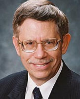
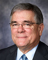
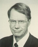
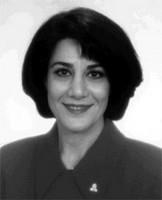
These developments took place under the leadership of David Goodenough (1992-1993), Andrew Blanchard (1994-1995), Martti Hallikainen (1996-1997), and Nahid Khazenie (1998-1999). Goodenough, of the Canada Centre for Remote Sensing’s Pacific Forestry Centre, and Executive Vice President Blanchard worked closely with AdCom to restructure the Society’s governance, leading to the creation of an expanded leadership model with an Executive Vice President and functional Vice Presidents – a structure that continues to form the basis of GRSS governance today. During Blanchard’s presidency, the Society established its first Technical Committees, creating new opportunities for member involvement in areas such as data fusion, data standardization and distribution, and instrumentation and future technology. Hallikainen’s administration continued to strengthen the Society’s organizational framework and, in 1997, initiated GRSS’s formal strategic planning process. Khazenie’s presidency, serving as the first female President of GRSS, closed the decade as these organizational reforms, together with expanding publications, conferences, and international participation, positioned GRSS for continued growth in the new millennium. Her tenure as President of GRSS also employed innovative management strategies that encouraged the advancement of women and minorities in science and technology, both within GRSS and IEEE.
Organizational Development and Governance Maturity
As Society activities expanded, the Administrative Committee (AdCom) assumed an increasingly complex role in coordinating operations across publications, conferences, membership, technical activities, and finances. The continued growth of IGARSS, combined with increasing manuscript volume in TGRS and expanding Chapter activity worldwide, required more formalized delegation of responsibilities.
During this period, GRSS refined its committee structure, strengthening the roles of Vice Presidents and standing committees in overseeing key Society functions. Responsibilities related to publications, conferences, membership development, technical coordination, and administrative operations were increasingly distributed across specialized committees rather than concentrated in individual leadership roles.
Goodenough explained the reorganization: “When I was President, the Vice President was Andy Blanchard…Andy and I worked together to restructure GRSS. We needed more Vice Presidents. We had to convince AdCom to change. The new structure became President, Executive Vice President, and Vice Presidents for basic areas.”
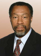
In 1994, the initial group of Technical Committees was formed to address Data Fusion, Data Standardization and Distribution, and Instrumentation and FutureTechnology. Technical Committees formed later addressed Frequency Allocation, Data Archiving, and International Imaging Spectroscopy. Much of the work to create the initial Technical Committees occurred during meetings at IGARSS’94, under the direction of Charles “Chuck” Luther, who is largely recognized as the champion behind forming Technical Committees.
This gradual institutionalization of responsibilities improved continuity between administrations. Many core functions – particularly those related to conference organization and publication oversight – became embedded in standing processes rather than relying solely on annual leadership transitions. As a result, the Society developed a more stable operational model capable of supporting sustained growth while preserving its volunteer-driven character.
Importantly, this evolution did not diminish the role of volunteer leadership. Instead, it formalized and extended it, allowing GRSS to manage increasing scale while maintaining the technical and professional engagement of its membership.
Publications and the Transition Toward Digital Workflows
The IEEE Transactions on Geoscience and Remote Sensing (TGRS) continued its steady expansion throughout the 1990s, reflecting the increasing volume and diversity of research in the field. Under editorial leadership including James A. Smith (1992-1995) and Leung Tsang (1996-2000), the journal continued to cover a broad range of topics spanning microwave remote sensing, radar systems, electromagnetic modeling, image processing, atmospheric science, oceanography, hydrology, cryospheric studies, and environmental applications.

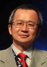
The growth of satellite Earth observation programs worldwide contributed directly to increased manuscript submissions. As new sensors and missions generated larger and more complex data sets, researchers increasingly relied on TGRS as a primary outlet for methodological development and scientific interpretation. A notable development during this period was the gradual transition toward electronic and digitally assisted publication workflows. While traditional editorial processes remained in place early in the decade, improvements in desktop computing and electronic communication increasingly supported manuscript handling, review coordination, and production workflows. By the late 1990s, these tools had begun to reshape the publication process, laying the groundwork for the fully digital systems that would follow in the early 2000s.
At the same time, advances in digital publishing improved the presentation of scientific results. Enhanced graphical capabilities, improved reproduction of imagery, and the increasing use of complex visualizations allowed authors to more effectively communicate the multidimensional nature of remote sensing data.
IGARSS as a Global Technical Forum
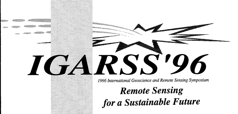 Throughout the 1990s, IGARSS continued its role as the Society’s principal technical conference and one of the most significant annual gatherings in the field of geoscience and remote sensing.
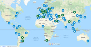
Symposia were held in Houston, Texas, USA (1992); Tokyo, Japan (1993); Pasadena, California, USA (1994); Florence, Italy (1995); Lincoln, Nebraska, USA (1996); Singapore (1997); Seattle, Washington, USA (1998); and Hamburg, Germany (1999). Tokyo (1993) represented the first Asian location for IGARSS, signaling the further globalization of the Symposium. This geographic distribution reflected the increasingly global character of the Society’s membership and the importance of maintaining accessibility for participants across multiple regions.

The technical scope of IGARSS expanded significantly during this decade. Sessions increasingly addressed synthetic aperture radar, interferometric SAR, microwave radiometry, hyperspectral sensing, optical and thermal imaging, image classification, electromagnetic scattering, atmospheric remote sensing, oceanographic applications, data assimilation, and environmental monitoring.
Tutorial sessions, poster sessions, exhibitions, panel discussions, and student participation became regular and expected components of the symposium program. These elements complemented the technical sessions by supporting professional development and fostering interaction across academia, government agencies, and industry.
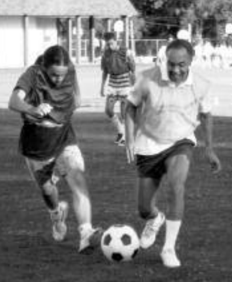
In addition, an annual soccer game had become a tradition at IGARSS. This encouraged networking and informal communication among attendees. In the image to the right, Eni Njoku, team North America, takes on a team member from the Rest-of-the-World at IGARSS’94 in Pasadena, California, USA.
Participation from major space agencies and research organizations – including NASA, the European Space Agency (ESA), the National Space Development Agency of Japan (NASDA), the Canadian Space Agency (CSA), and other national and international institutions – reinforced IGARSS as a central venue for global scientific exchange in remote sensing.
During this era, GRSS also expanded its technical forums through participation in small conferences and workshops. Following a request from Paolo Pampaloni at the 1998 Seattle AdCom meeting, GRSS co-sponsored MicroRad (Specialist Meeting on Microwave Radiometry and Remote Sensing of the Environment) in Florence, Italy, in March 1999, launching a growing program of co- and technically sponsored meetings. In 1999 alone, this also included the Conference on Remote Sensing Education (CORSE) in Boulder, Colorado, the International Conference on Agropoles and Agro-Industrial Technology Parks in Brazil, and the Littoral Remote Sensing Conference in Greece.
Remote Sensing Moves Toward Operational and Multi-Mission Use
A defining feature of the 1990s was the increasing operational use of Earth observation systems. Missions such as ERS-1, ERS-2, JERS-1, and RADARSAT-1, along with continued Landsat operations, provided consistent multi-year datasets supporting observations of land, oceans, atmosphere, and cryosphere. The growing availability of reliable satellite observations expanded the ability to monitor Earth’s dynamic systems through sustained, repeat observations.
Specifically, the C-band Synthetic Aperture Radar (SAR) on ERS-1 and ERS-2 enabled the early deployment of satellite radar interferometry (InSAR) to map ground surface deformations and ice sheet velocities. Concurrently, the launch of RADARSAT-1 in 1997 provided the first routine, conflict-free commercial access to steerable radar beams, which researchers used to execute the comprehensive mapping of the entire Antarctic ice sheet.
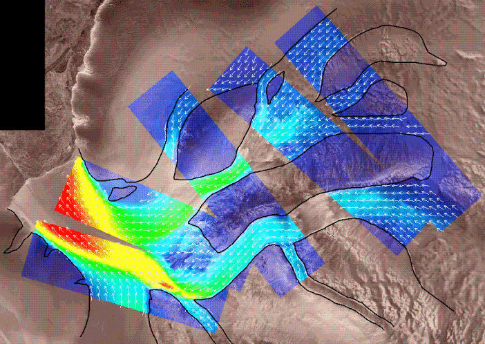
These missions generated increasing volumes of observational data and created new demands for calibration, validation, long-term data consistency, and data management. For GRSS members, the expanding availability of operational satellite observations presented both new scientific opportunities and engineering challenges. Research published in TGRS and presented at IGARSS increasingly addressed quantitative retrieval methods, calibration and validation, and the integration of observations from multiple sensor systems. Rapid improvements in computing power, digital storage, and image processing software also transformed the practice of remote sensing, enabling researchers to analyze increasingly large and complex satellite datasets.
Emerging Technical Directions
The expanding availability of satellite observations also accelerated advances in remote sensing methodology. The technical programs of IGARSS and papers published in IEEE Transactions on Geoscience and Remote Sensing increasingly featured developments in interferometric SAR, hyperspectral image analysis, polarimetric radar, microwave retrieval algorithms, and multi-sensor data fusion, reflecting the evolving capabilities of Earth observation systems.
 For example, the 1997 study by Cloude and Pottier in IEEE Transactions on Geoscience and Remote Sensing (January 1997) introduced an entropy-based classification approach for fully polarimetric SAR data, illustrating advances in radar signal interpretation and feature extraction that were representative of broader methodological developments in GRSS publications during this period.
Synthetic aperture radar interferometry matured from an emerging research topic into a practical technique for measuring surface topography and deformation. Polarimetric SAR advanced understanding of scattering mechanisms from vegetation, soils, and cryospheric surfaces, while improvements in microwave radiative transfer modeling supported more accurate retrievals of environmental parameters.
At the same time, hyperspectral remote sensing emerged as an important area of investigation following the successful deployment of airborne instruments such as NASA’s AVIRIS. Researchers developed methods for extracting physical and chemical information from hundreds of spectral bands, opening new applications in geology, agriculture, forestry, and environmental monitoring.
Data fusion and multi-sensor analysis also became increasingly important as investigators sought to combine radar, optical, thermal, and ancillary geospatial information into more comprehensive representations of the Earth’s surface. Together, these developments became important themes in GRSS publications and conferences throughout the remainder of the decade.
Education, Chapters, and Member Development
As the field expanded and GRSS expanded internationally, the Society increased its emphasis on education, training, and member support. Tutorials and short courses associated with IGARSS became established features of the annual symposium, providing structured opportunities for researchers and practitioners to learn emerging methods and technologies directly from leading experts in the field.
Regional Chapters played an increasingly important role in supporting year-round technical activity. Through seminars, workshops, and local meetings, Chapters helped extend the Society’s presence beyond the annual symposium and strengthened professional networks in Europe, Asia, and the Americas.
These activities contributed to a more distributed model of professional engagement, reinforcing GRSS as a global organization rather than one centered primarily on a single geographic region.
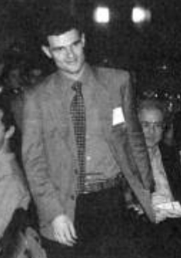
The Society also broadened its commitment to recognizing emerging talent. In conjunction with IGARSS 1998 in Seattle, GRSS established the Student Prize Paper Competition to recognize outstanding student research and presentations. The inaugural award was presented to Lorenzo Bruzzone of the University of Genoa for his paper on Bayesian classification of remote sensing images, reflecting the Society’s growing investment in encouraging the next generation of remote sensing researchers, and marking the beginning of a program that continues to encourage and recognize excellence among student researchers.
Expanding International Participation
The 1990s were characterized by broad international participation in GRSS conferences and publications, with significant contributions from researchers affiliated with major space and research organizations including NASA, the European Space Agency (ESA), the National Space Development Agency of Japan (NASDA), the Canadian Space Agency (CSA), and other national institutions. This global participation was reflected in both TGRS authorship and the technical programs of IGARSS, reinforcing the Society’s role as a central international forum for geoscience and remote sensing research.
Many GRSS members also contributed individually to the analysis and interpretation of data from operational Earth observation missions, including activities such as algorithm development, calibration and validation studies, and application-focused use of multi-mission satellite datasets.
Legacy of the 1990s
By the end of the 1990s, the IEEE Geoscience and Remote Sensing Society had further matured, and was a globally respected professional organization operating at the intersection of engineering innovation and Earth system science. The era was defined not by a single transformation, but by the steady expansion and integration of the Society’s core activities. Publications grew in volume and sophistication, IGARSS strengthened its role as a global technical forum, governance structures became more formalized, and educational and Chapter activities expanded internationally.
By 1999, the Society was fully positioned to enter the 21st century as a mature international organization capable of supporting both scientific advancement and a rapidly expanding global community of practitioners.
Next month we will explore “The History of IEEE GRSS at 65 (2000-2006): Entering the New Millennium.”
Take a Closer Look:
- NASA: A Brief History of the RADARSAT-1 Antarctic Mapping Project
- “An Entropy Based Classification Scheme for Land Applications of Polarimetric SAR,” S.R. Cloude; E. Pottier, IEEE Transactions on Geoscience and Remote Sensing, (Volume: 35, Issue: 1, January 1997)
- IEEE GRSS Technical Committees
- IEEE GRSS Past Presidents