Tuesday, May 7, 2019
14:00 GMT/UTC
10:00 AM US Eastern Time
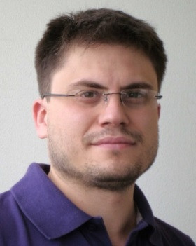
Speaker: Dr. Matteo Pardini, DLR, Germany
Sponsored by GRSS
 Polarimetric Synthetic Aperture Radar Tomography for 3-D Imaging of Natural Volumes
Synthetic Aperture Radar (SAR) systems are capable of imaging large areas systematically at high spatial and temporal resolutions. At the same time, depending on the wavelength, the transmitted radiation can penetrate into natural volumes (e.g. forests, ice bodies and agricultural vegetation), thus providing information about the 3-D structure of such media. However, the availability of one single (polarimetric) SAR image does not allow to extract 3-D information.
The possibility of a direct 3-D imaging of natural volumes has been successfully demonstrated with polarimetric SAR Tomography (TomoSAR). TomoSAR techniques provide an estimate of a continuous 3-D radar backscattering profile without the need of scattering models. Since the first airborne experiment, in the last 20 years TomoSAR has demonstrated very promising potentials in solving essential SAR remote sensing problems. The widely recognized added value of TomoSAR 3-D imaging has led to its implementation in spaceborne SAR missions of the latest generation.
SPEAKER’S BIO:
Matteo Pardini (S’02 – M’10) received the Ms. Eng. Degree (cum laude) in Telecommunication Engineering and the Ph.D. in Information Engineering from the University of Pisa (Italy) in 2006 and 2010, respectively. In January 2010, he joined the Radar Concepts department of the Microwaves and Radar Institute of the German Aerospace Center (DLR) in Oberpfaffenhofen (Germany) as a research scientist, after a visiting research period from August to December 2009. In 2017, he was Visiting Scientist at the Department of Geographical Sciences of the University of Maryland (USA). His main research interests are in Synthetic Aperture Radar (SAR) tomographic and polarimetric interferometric processing for 3-D bio/geophysical information extraction over natural volumes (forest, agriculture, ice), as well as in SAR mission design and SAR mission performance analysis


