


By Joanne Van Voorhis
 The 3rd Computer Vision for Earth Observation Workshop (CV4EO) will be held March 7 in conjunction with the IEEE/CVF Winter Conference on Applications of Computer Vision (WACV) in Tucson, Arizona. WACV is sponsored by the Computer Vision Foundation (CVF) and the IEEE Computer Society, runs March 6-10, and provides a forum for computer vision researchers working on practical applications and innovative algorithms to share their latest developments.
As a day-long GRSS-sponsored workshop within the larger event, CV4EO 2026 continues prior successful workshops in 2024 and 2025 dedicated to advancing the intersection of computer vision, machine learning, and geoscience. It serves as a platform for multidisciplinary collaboration, bringing together computer vision researchers, geoscience experts, government agencies, non-profit organizations, and Earth observation data providers to explore how AI and computer vision technologies can support applications such as disaster response, security, and environmental protection.
Exploring Computer Vision for Earth Observation
As Earth observation platforms generate unprecedented volumes of multimodal satellite and airborne data, the need for scalable, reliable computer vision methods has become increasingly important. CV4EO provides a focused venue within WACV for researchers and practitioners working to translate advances in AI into practical tools for environmental monitoring, disaster response, agriculture, climate science, and sustainable development.

“This workshop is particularly important right now because both computer vision and Earth observation have entered a phase of real maturation,” explains Ronny Hänsch, CV4EO Co-Organizer. “Their intersection is no longer experimental, but increasingly operational. IEEE GRSS and in particular its Image Analysis and Data Fusion (IADF) Technical Committee, are on the frontline of connecting the Earth observation community with machine learning and computer vision researchers by establishing and supporting workshops and events at several major conferences. Through CV4EO at WACV, we bring together leading CV and ML scientists, remote sensing experts, practitioners from industry and government, and especially early-career researchers and students who want to shape the next generation of AI-driven Earth observation solutions,” he adds.
Participants can expect to explore topics such as foundation models for Earth observation applications, data fusion and multimodal learning, agentic AI in remote sensing, and emerging advances such as quantum machine learning for Earth observation and diffusion models for remote sensing data synthesis, plus practical computer vision and machine learning for low resource Earth observation applications, as well as benchmarking and evaluation protocols for downstream applications.
Keynote Speakers Reflect Broad Range of Experiences

“We have assembled a really strong group of keynote speakers for the Computer Vision for Earth Observation Workshop who are very involved in shaping the future of computer vision for Earth observation applications,” says Dalton Lunga, CV4EO Co-Organizer. “They include experts with diverse backgrounds in machine learning, computer vision, and geospatial applications development,” he adds.
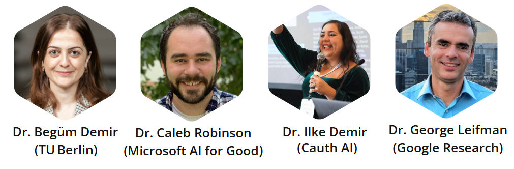
Dr. Begüm Demir is a Full Professor at Technische Universität Berlin (TU Berlin) in Germany, where she serves as the founder and head of the Remote Sensing Image Analysis (RSiM) research group within the Faculty of Electrical Engineering and Computer Science. In addition, she leads the Big Data Analytics for Earth Observation research group at the Berlin Institute for the Foundations of Learning and Data (BIFOLD). Dr. Caleb Robinson is a Principal Research Science Manager at the Microsoft AI for Good Research Lab and co‑leads the Geospatial Machine Learning group, focusing on tackling large scale applied problems at the intersection of remote sensing and machine learning/computer vision. Dr. Ilke Demir (Cauth AI) is a Senior Research Scientist whose work spans computer vision, generative models, deep learning, and geospatial machine learning. Dr. George Leifman is a Research Scientist at Google Research focused on developing vision‑language foundation models for satellite and aerial imagery, bringing experience in machine learning and large‑scale vision systems. Together, the keynote speakers bring experience from academia, industry research labs, and applied AI initiatives focused on real-world impact.
Collaboration, Networking, and the Exchange of Ideas

In addition to putting together a great keynote speaker lineup, Organizing Chairs have worked to develop events during the day to encourage interaction and collaboration. There will be multiple “lightning talks” on a wide range of topics with Q&A sessions – and poster sessions, coffee breaks and lunch provide networking opportunities for attendees and presenters to informally share research and ideas.
“Collaboration and networking are absolutely central to why we organize events like this,” explains Philipe Dias, CV4EO Co-Organizer. “Computer vision for Earth observation is advancing fast, especially with the rapid evolution of AI and ever increasing amounts of EO data available. Oftentimes there are many research groups across the globe tackling similar problems from different perspectives (a different methodology, target application, data sources). Workshops enable an exchange of ideas and experiences that can be beneficial to form collaborations that move the field forward collectively. They provide a critical space to reflect as a community: What are we doing well? Where are the gaps? Which benchmarks, datasets, and best practices should we be converging around? What open challenges remain unsolved?“ he adds.
Registration is Open – Please Join us in Tucson!

“The scope of this workshop is intentionally broad and inclusive,” says Philipe Dias. “Whether someone is new to geospatial data or is already developing state-of-the-art methods for Earth observation, the program is designed to offer value to all types of audiences. For practitioners, the workshop is an opportunity to catch up on the latest resources, datasets, benchmarks, and practical lessons from recent deployments. For computer vision and AI researchers, it offers exposure to a uniquely rich and challenging domain, with important questions about scale, domain shift, multimodality, robustness, and societal impact. Earth observation applications frequently push the boundaries of current methods, creating opportunities to advance core CV/AI research,” he explains.
We hope you will join us in Tucson – a city known for its desert landscapes, proximity to Saguaro National Park, and a vibrant research community. Researchers, practitioners, students, and industry professionals interested in applied computer vision and its impact on global challenges are encouraged to attend. For more information, visit geoai.ornl.gov/cv4eo-wacv/. Registration for WACV 2026, which includes access to workshops such as CV4EO (March 7 in the AZ Ballroom Salon 10-11), is available through the official conference website. (wacv.thecvf.com/).
CV4EO Co-Organizers:
- Dr. Philipe Dias
- Dr. Ronny Hänsch
- Dr. Dalton Lunga
- Dr. Manil Maskey
- Dr. Abby Stylianou
- Dr. Jiaqi Yang
- Dr. Zhuo Zheng