TGRS Editorial Board
TGRS Topical Deputy Editor-in-Chief
| Last Name, First Name | Affiliation | Area | |
  | Chen, Kun-Shan | Nanjing University, China | Radar signal and image processing, wave propagation and scattering, microwave system engineering, microwave remote sensing, and communication |
  | Chen, Xudong | National University of Singapore, Singapore | Electromagnetic wave theories, LiDAR, geophysical data and applications |
  | Johnson, Joel | The Ohio State University, USA | Electromagnetic wave theory, Microwave radiometry, Radar, GNSS-R, applications |
  | Li, Xuelong | Northwestern Polytechnical University, China | Optical imagery analysis and learning |
  | Li, Zhao-Liang | National Center for Scientific Research, France | Thermal infrared remote sensing, Land surface modelling |
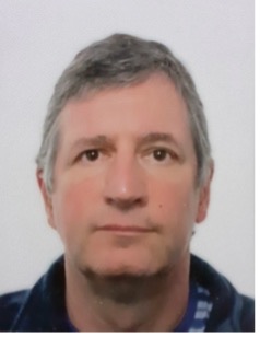  | Scheunders, Paul | University of Antwerp, Belgium | Hyperspectral image processing, multisource data fusion, machine learning |
TGRS Associate Editors
Krishna Agarwal
UiT The Arctic University of Norway, Norway
Inverse imaging.
Thomas Ainsworth
Kent State University, USA
SAR / PolSAR applications and techniques, general image analysis.
Erchan Aptoula
Sabanci University, Turkey
Image analysis, pattern recognition, deep learning.
Motofumi Arii
Mitsubishi Electric Corporation
PolSAR theory, data analysis and applications
Jagannath Aryal
The University of Melbourne, Australia
Object recognition using computer vision, spatial statistics, deep learning architectures.
Xueru Bai
Xidian University, China
Radar imaging and radar target detection/classification.
Yifang Ban
KTH Royal Institute of Technology, Sweden
Earth observation big data analytics, multi-sensor data fusion, machine learning/deep learning for mapping urbanization and land cover dynamics, monitoring wildfires and other natural hazards and assessing their environmental impact.
Yakoub Bazi
King Saud University, Saudi Arabia
Image video analysis and data fusion.
Rajat Bindlish
NASA Goddard Space Flight Center, USA
Application of microwave remote sensing in hydrology, soil moisture estimation from microwave sensors and their subsequent application in land surface hydrology.
Filippo Biondi
Strathclyde University, UK
Remote sensing and SAR.
Maurice Borgeaud
Retiree from European Space Agency (ESA), Switzerland
Radar remote sensing for land applications, SAR interferometry and polarimetry, disaster monitoring with EO data, science and applications for future EO missions.
Mark Bourassa
Florida State University, USA
Air-Sea interaction.
Shannon Brown
Jet Propulsion Laboratory, USA
Microwave radiometer instrument design and applications.
Lorenzo Bruzzone
University of Trento, Italy
Image and signal processing, artificial intelligence, radar, and SAR.
Hugo Carreno-Luengo
University of Michigan, USA
GNSS-Reflectometry methods, applications, and technology.
Daniele Cerra
German Aerospace Center (DLR), Germany
Imaging spectroscopy.
Chein-I Chang
University of Maryland, Baltimore County (UMBC), USA
Hyperspectral image processing.
Jocelyn Chanussot
University Grenoble Alpes, France
Data processing, data fusion, optical and hyperspectral remote sensing, artificial intelligence.
Jiefu Chen
University of Houston, USA
Electromagnetic forward & inverse modeling and geophysical data processing.
Yangkang Chen
The University of Texas at Austin, USA
Seismic data processing, inversion, and imaging.
Yiping Chen
Sun Yat-sen University, China
3D LiDAR, point cloud intelligent and deep learning processing, AI-based geomatics, and remote sensing image processing.
Marco Chini
Luxembourg Institute of Science and Technology, Luxembourg
Remote sensing, classification, urban monitoring and natural resource and disaster management.
David Clausi
University of Waterloo, Canada
Computer vision to study remote sensing images with a career emphasis on sea ice.
Qian Du
Mississippi State University, USA
Hyperspectral data processing and analysis.
Stephen Durden
Jet Propulsion Laboratory, California Institute of Technology, USA
Weather radar.
Leyuan Fang
Hunan University, China
High-resolution remote sensing image intelligent analysis.
Mathieu Fauvel
INRAe, France
Analyse of massive irregular and unaligned satellite image time series for environmental issue.
Sergey Fomel
University of Texas at Austin, USA
Geophysical data analysis.
Stephen Frasier
University of Massachusetts Amherst, USA
Microwave remote sensing and systems.
Jinghuai Gao
Xi’an Jiaotong University, China
Major scientific problems in unconventional oil and gas exploration and development.
Lianru Gao
Chinese Academy of Sciences, China
Hyperspectral and optical image analysis.
Andrea Garzelli
University of Siena, Italy
Spatial enhancement, change detection, and fusion from optical and SAR sensors.
Christoph Gierull
Defence R&D Canada, Canada
SAR signal processing.
Francisco Grings
Institute of Astronomy and Space Physics (IAFE), Argentina
Surface parameters retrieval from SAR images using Bayesian and machine learning techniques.
Yanfeng Gu
Harbin Institute of Technology, China
Data processing and applications for hyperspectral and LiDAR remote sensing.
Uta Heiden
DLR Oberpfaffenhofen, Germany
Urban spectroscopy, urban hyperspectral applications, urban spectral libraries, soil information retrieval, solar panel detection, and characterization.
Danfeng Hong
Chinese Academy of Sciences, China
Artificial intelligence for multimodal remote sensing in earth observation.
Decheng Hong
Jilin University, China
Geophysical data processing and modeling.
Weimain Huang
Memorial University, Canada
Ocean remote sensing, ocean radars (high-frequency surface/sky wave radar, X- or S-band marine radar, GNSS-R, SAR), electromagnetic (EM) scattering from sea surface, machine learning for ocean remote sensing.
Xin Huang
Wuhan University, China
Deep learning for remote sensing.
Sen Jia
Shenzhen University, China
Hyperspectral data processing.
Licheng Jiao
Xidian University, China
AI for remote sensing image processing and perception.
Shuanggen Jin
Henan Polytechnic University, China
GNSS and planetary remote sensing.
Gerhard Krieger
German Aerospace Center (DLR) & Friedrich Alexander University (FAU), Germany
SAR techniques, systems, missions and applications, with special focus on bi-static and multi-static SAR, high-resolution wide-swath SAR imaging employing new digital beamforming and MIMO-SAR modes.
Mehmet Kurum
Mississippi State University, USA
Active passive microwave remote sensing and signals of opportunity.
Chiman Kwan
Signal Processing, Inc., USA
Anomaly and change detection, target detection, image enhancement, and image fusion, and classification using multispectral/hyperspectral image.
Zhongping Lee
University of Massachusetts Boston, USA
Ocean color remote sensing.
Juha Lemmetyinen
Finnish Meteorological Institute, Finland
Microwave remote sensing of seasonal snow cover, vegetation, and soil properties.
Jonathan Li
University of Waterloo, Canada
LiDAR remote sensing and point cloud analytics, Geospatial mapping of urban areas.
Maokun Li
Tsinghua University, China
Subsurface imaging, electromagnetic, and multi-physics data inversion.
Shutao Li
Hunan University, China
Remote sensing image processing and multi-source information fusion.
Wei Li
Beijing Institute of Technology, China
Hyperspectral image analysis.
Xiaofeng Li
Chinese Academy of Sciences, China
Ocean remote sensing.
Yansheng Li
Wuhan University, China
Deep learning and image analysis.
Wenming Lin
Nanjing University of Information Science and Technology, China
Remote sensing of sea surface winds.
Li Liu
Chinese Academy of Sciences, China
Ocean remote sensing.
Jianwei Ma
Peking University, China
Geophysical data processing, seismic imaging, and inversion, artificial intelligence in geophysics, data assimilation.
Giovanni Macelloni
National Research Council – Institute of Applied Physics “Nello Carrara” (CNR-IFAC), Italy
Active and passive microwave remote sensing with particular attention to the cryosphere.
Anthony Mannucci
Jet Propulsion Laboratory, California Institute of Technology, USA
Remote sensing using signals of opportunity such as global navigation satellite signals.
José Marcato Junior
Federal University of Mato Grosso do Sul, Brazil
Remote sensing, Photogrammetry, and deep learning applied to environmental studies.
Manuel Martin-Neira
European Space Agency, France
Aperture synthesis microwave radiometry and GNSS reflectometry.
Shaohui Mei
Northwestern Polytechnical University, China
Hyperspectral and optical remote sensing.
Maurizio Migliaccio
Università degli Studi di Napoli Parthenope, Italy
SAR polarimetry, marine and maritime remote sensing, remote sensing for societal advancement.
Dongping Ming
China University of Geosciences (Beijing), China
Remote sensing image processing and understanding, geologic hazard monitoring and warning.
Alberto Moreira
German Aerospace Center – DLR, Germany
Synthetic Aperture Radar (SAR).
Jose Moreno
University of Valencia, Spain
Optical remote sensing of land surfaces.
Mostafa Mousavi
Stanford University, Google, USA
Seismic data processing and analyses.
Ryo Natsuaki
The University of Tokyo, Japan
Synthetic aperture radar.
Paolo Pampaloni
CNR-IFAC, Florence, Italy
Microwave remote sensing of land.
Li Pan
Huawei Singapore Research Center, Singapore
Electromagnetic simulation and inversion, computational imaging, geophysical data processing and inversion.
Stefano Perna
Università degli Studi di Napoli “Parthenope”, Italy
Synthetic aperture radar: systems, data processing and applications.
Claudio Persello
University of Twente, Netherlands
Machine learning and deep learning for information extraction from remotely sensed images and geospatial data.
Nazzareno Pierdicca
Sapienza University of Rome, Italy
Microwave remote sensing active and passive, electromagnetic modeling.
Saied Pirasteh
Shaoxing University, China
Geospatial data science, GeoAI, natural hazards and disasters, applications beyong, remote sensing computer vision (including satellite, drone, and LiDAR), data processing, as well as GIS and Geospatial information analysis and management for specific purposes.
Ying Qu
Beijing Normal University, China
Remote sensing data analysis based on artificial intelligence.
Jinchang Ren
Robert Gordon University, Scotland, UK
Hyperspectral image analysis, computer vision, and machine learning as well as their applications in remote sensing.
Peng Ren
China University of Petroleum (East China), China
Maritime Remote Sensing, Underwater Imaging, Artificial Intelligence, etc.
Adria Rovira-Garcia
Universitat Politecnica de Catalunya, Spain
Ionospheric research applied to precise point positioning by means of the global navigation satellite system.
Christopher Ruf
University of Michigan, USA
Microwave remote sensing applications, methods, and technology.
Dustin Schroeder
Stanford University, USA
Radar sounding of ice sheets, glaciers, and ice shells on Earth and across the solar system.
Jie Shan
Purdue University, USA
Photogrammetry, LiDAR, geospatial data analytics.
Zhenwei Shi
Beihang University, China
Optical remote sensing image processing, machine learning, and computer vision.
Yanmin Shuai
Zhejiang Normal University, China
Vegetation remote sensing, land use and land cover, multi-spectrum or hyperspectral image analysis.
Ramesh P Singh
Chapman University, USA
Earth system science.
Francesco Soldovieri
National Research Council, Italy
Radar imaging, marine radar, ground penetrating radar, inverse scattering.
Xiaoning Sing
University of Chinese Academy of Sciences, China
Quantitative remote sensing for estimation of land surface parameters, such as soil moisture, leaf area index, evapotranspiration, NPP, soil organic matter.
Bryan Stiles
Jet Propulsion Laboratory, California Institute of Technology, USA
Simulations, ground processing, and data analysis algorithms for spaceborne radar, including SAR image formation of the surface of Titan from Cassini, ocean wind retrieval from numerous scatterometers, and sea surface height determination from the SWOT KaRIn interferometric SAR.
Ad Stoffelen
KNMI, Netherlands
Atmospheric and ocean surface satellite-based wind sensing.
Genyun Sun
China University of Petroleum, China
Earth observation big data analytics, machine learning/deep learning for mapping urbanization and land cover, hyperspectral remote sensing.
Weiwei Sun
Ningbo University, China
Machine learning and multisource remote sensing (hyperspectral, pan, multispectral, LiDAR, and SAR) data processing and analysis.
Stefano Tebaldini
Politecnico di Milano, Italy
Radar data processing, scientific retrieval, and development of new mission concepts.
Saibun Tjuatja
The University of Texas at Arlington, USA
Electromagnetic scattering and emission models for random media; radar imaging, subsurface sensing, and imaging.
Ridha Touzi
Canada Centre for Remote Sensing, Canada
Polarimetric SAR calibration, methods, and applications.
Gabriel Vasile
French National Center for Scientific Research (CNRS), France
Remote sensing data processing & analysis, earth observation, speckle, radar, polarimetry, interferometry, tomography, acoustics, and vibration.
Michelangelo Villano
German Aerospace Center (DLR), Germany
Synthetic aperture radar (SAR).
Gemine Vivone
National Research Council of Italy, Italy
Image fusion and pansharpening.
Umair bin Waheed
King Fahd University of Petroleum and Minerals, Saudi Arabia
Applied machine learning, geophysical modeling and inversion, seismic imaging, induced seismicity.
Dongdong Wang
University of Maryland, USA
Remote sensing of earth radiation and energy budget.
Qi Wang
Northwestern Polytechnical University, China
Remote sensing image processing, analysis, and understanding.
Yong Wang
University of Electronic Science and Technology of China, China
Polarimetric SAR technique in earth observation and application, surface variation with InSAR techniques, multitemporal SAR.
Zhun Wei
Zhejiang University, China
Inverse problem, electromagnetics in remote sensing, scientific machine learning.
Fuzhong Weng
Centre for Earth System Modeling and Prediction, China
Radiative transfer for satellite data assimilation and remote sensing applications.
Hua Wu
University of Electronic Science and Technology of China, China
Thermal infrared remote sensing.
Yong Xie
Nanjing University of Information Science &Technology, China
Research on signal and image processing, quantitative retrieval of satellite remote sensing, radiometric calibration of optical sensors, and validation of remote sensing products.
Mengdao Xing
Xidian University, China
SAR Remote Sensing.
Feng Xu
Fudan University, China
EM scattering theory and SAR information retrieval.
Kuiwen Xu
Hangzhou Dianzi University, China
Electromagnetic wave inversion and Learning-aware imaging.
Xiaofeng Yang
Chinese Academy of Sciences, China
Satellite oceanography from microwave remote sensing observations.
Xiuzhu Ye
Beijing Institute of Technology, China
Wave physics, inverse scattering, machine learning and signal processing.
Junjun Yin
University of Science and Technology, Beijing
Polarimetric SAR image processing and Polarimetric target decompositions.
Xiaobin Yin
Ocean University of China, China
Ocean microwave remote sensing and applications.
Naoto Yokoya
The University of Tokyo, Japan
Computational imaging and vision for remote sensing.
Yongtao Yu
Huaiyin Institute of Technology, China
LiDAR data and optical remote sensing image processing.
Bing Zhang
Chinese Academy of Sciences, China
Hyperspectral image processing and applications.
Guifu Zhang
University of Oklahoma, USA
Weather radar polarimetry.
Hongsheng Zhang
The University of Hong Kong, China
Coastal remote sensing/data fusion/synthetic aperture radar.
Junping Zhang
Harbin Institute of Technology, China
Optical and hyperspectral image processing.
Xiangrong Zhang
Xidian University, China
Remote sensing image processing and understanding.
Yanning Zhang
Northwestern Polytechnical University, China
Image processing and analysis.
Zhiqin Zhao
University of Electronic Science and Technology of China, China
EM modeling and its applications.
Yu Zhong
FINIAC, Pte. Ltd.; UiT, the Arctic University of Norway, Norway
Inverse problems associated with electromagnetic waves.
Jun Zhou
Griffith University, Australia
Hyperspectral data processing.
Yicong Zhou
University of Macau, China
Remote sensing image processing and analysis.
Xiaoxiang Zhu
Technical University of Munich (TUM), Germany
Data science in earth observation.
TGRS Topical Associate Editors
Emmanuel Dinnat
NASA Goddard Space Flight Center, USA
Active and passive microwave remote sensing, sea surface salinity, scattering from rough surfaces, atmospheric radiative transfer, numerical simulations, and interactions between the cryosphere and high latitude oceans.
Moussa Sofiane Karoui
Algerian Space Agency, Algeria
Linear/nonlinear unmixing techniques with applications to remote sensing imagery.
Yang Lei
Chinese Academy of Sciences, China
Radar remote sensing, synthetic aperture radar, interferometry/inSAR, radar sounding, forest, snow, ice, planetary subsurface, electromagnetic scattering modeling, and simulation.
Jiangtao Peng
Hubei University, China
Hyperspectral image processing and machine learning.
Bouwmans Thierry
Laboratoire MIA, La Rochelle Université, France
Detection of moving objects from data acquired by passive or active sensors in challenging surface (ground and sea), air and space environments using mathematical tools, machine learning concepts and signal processing concepts.
Xin Wu
Beijing University of Posts and Telecommunications, China
Object detection, target/anomaly detection, intelligent perception, multimodal data fusion.
Fengchao Xiong
Nanjing University of Science and Technology, China
Hyperspectral data processing.
Stephen Yan
Private
Radar systems, antennas, electromagnetics and signal processing.
Hanwen Yu
University of Electronic Science and Technology of China, China
SAR/InSAR signal processing and application.
Lefei Zhang
Wuhan University, China
Deep learning, image processing.
Simon Zwieback
University of Alaska Fairbanks, USA
Characterizes permafrost landscape dynamics using InSAR.


