Contact Information:
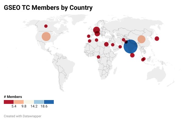
The GRSS Standards for Earth Observation (GSEO) encourages participation from all its members.
Chair
 | Dr. Siri Jodha Khalsa National Snow and Ice Data Center USA |
Co-Chair
 | George Percivall GeoRoundtable USA |
 | Hugo Carreno-Luengo |
Current Standards Projects
- Characterization and Calibration of Hyperspectral Imaging Devices Working Group (P4001)
- Synthetic Aperture Radar Metadata Content Working Group (P4002)
- Global Navigation Satellite System-Reflectometry Data and Metadata Content Working Group (P4003)
- Calibration of microwave radiometers Working Group (P4004)
- Standards and protocols for soil spectroscopy Working Group (P4005)
- Remote Sensing RFI Impact Assessment Working Group (P4006)
Working Groups:
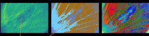
Characterization and Calibration of Hyperspectral Imaging Devices Working Group (P4001)
This standard defines performance characteristics for hyperspectral cameras, as well as metadata for hyperspectral images, for a set of use cases defined to represent a wide range of applications.

Synthetic Aperture Radar Metadata Content Working Group (P4002)
The scope of this standard involves the metadata for describing airborne and spaceborne Synthetic Aperture Radar (SAR) data. This standard specifies the metadata content structure, as well as the text representation.
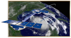
Global Navigation Satellite System Reflectometry Data and Metadata Content Working Group (P4003)
The scope of this standard involves the metadata for describing airborne and spaceborne Synthetic Aperture Radar (SAR) data. This standard specifies the metadata content structure, as well as the text representation.
 Standards and Protocols for Soil Spectroscopy (P4005)
 Standards and Protocols for Soil Spectroscopy (P4005)
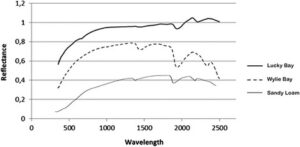
This Standard defines protocols and schemes for sensors and measurement methods when merging, comparing and utilizing Soil Spectral Libraries (SSLs) from many sources, as well as monitoring their measurement scheme before performing data manipulation or quantitative analyses. Using the standard SSLs is an important stage while utilizing Hyperspectral (HSI) data for monitoring and mapping soils.
RFI in Remote Sensing Working Group (P4006)
 RFI in Remote Sensing Working Group (P4006)
This standard defines the quantitative assessment of man-made RFI in a given frequency band. Specifically, this standard is intended to be used in RFI impact evaluations and monitoring of frequency bands allocated to space-based remote sensing. The standard provides a definition of RFI as it relates to space-based remote sensing operations.