Optical Remote Sensing of Ocean Hydrodynamics
Victor Raizer
Optical Remote Sensing is one of the main technologies used in sea surface monitoring. Optical Remote Sensing of Ocean Hydrodynamics investigates and demonstrates capabilities of optical remote sensing technology for enhanced observations and detection of ocean environments. It provides extensive knowledge of physical principles and capabilities of optical observations of the oceans at high spatial resolution, 1-4m, and on the observations of surface wave hydrodynamic processes. It also describes the implementation of spectral-statistical and fusion algorithms for analyses of multispectral optical databases and establishes physics-based criteria for detection of complex wave phenomena and hydrodynamic disturbances including assessment and management of optical databases.
This book explains the physical principles of high-resolution optical imagery of the ocean surface, discusses for the first time the capabilities of observing hydrodynamic processes and events, and emphasizes the integration of optical measurements and enhanced data analysis. It also covers both the assessment and the interpretation of dynamic multispectral optical databases and includes applications for advanced studies and nonacoustic detection.
Available here.
Introduction to Microwave Remote Sensing
Iain H. Woodhouse
Introduction to Microwave Remote Sensing offers an extensive overview of this versatile and extremely precise technology for technically oriented undergraduates and graduate students.
This textbook emphasizes an important shift in conceptualization and directs it toward students with prior knowledge of optical remote sensing: the author dispels any linkage between microwave and optical remote sensing. Instead, he constructs the concept of microwave remote sensing by comparing it to the process of audio perception, explaining the workings of the ear as a metaphor for microwave instrumentation.
This volume takes an “application-driven” approach. Instead of describing the technology and then its uses, this textbook justifies the need for measurement then explains how microwave technology addresses this need.
Following a brief summary of the field and a history of the use of microwaves, the book explores the physical properties of microwaves and the polarimetric properties of electromagnetic waves. It examines the interaction of microwaves with matter, analyzes passive atmospheric and passive surface measurements, and describes the operation of altimeters and scatterometers. The textbook concludes by explaining how high resolution images are created using radars, and how techniques of interferometry can be applied to both passive and active sensors.
Available here.
Introduction to Satellite Remote Sensing
William Emery, Adriano Camps
Introduction to Satellite Remote Sensing: Atmosphere, Ocean and Land Applications is the first reference book to cover ocean applications, atmospheric applications, and land applications of remote sensing.
Applications of remote sensing data are finding increasing application in fields as diverse as wildlife ecology and coastal recreation management. The technology engages electromagnetic sensors to measure and monitor changes in the earth’s surface and atmosphere.
The book opens with an introduction to the history of remote sensing, starting from when the phrase was first coined. It goes on to discuss the basic concepts of the various systems, including atmospheric and ocean, then closes with a detailed section on land applications.
Available here.
Land Use and Spatial Planning
Graciela Metternicht
This book reconciles competing and sometimes contradictory forms of land use, while also promoting sustainable land use options. It highlights land use planning, spatial planning, territorial (or regional) planning, and ecosystem-based or environmental land use planning as tools that strengthen land governance. Further, it demonstrates how to use these types of land-use planning to improve economic opportunities based on sustainable management of land resources, and to develop land use options that strike a balance between conservation and development objectives.
Competition for land is increasing as demand for multiple land uses and ecosystem services rises. Food security issues, renewable energy and emerging carbon markets are creating pressures for the conversion of agricultural land to other uses such as reforestation and biofuels. At the same time, there is a growing demand for land in connection with urbanization and recreation, mining, food production, and biodiversity conservation. Managing the increasing competition between these services, and balancing different stakeholders’ interests, requires efficient allocation of land resources.
Available here.
Advances in Passive Microwave Remote Sensing of Oceans
Victor Raizer
This book demonstrates the capabilities of passive microwave technique for enhanced observations of ocean features, including the detection of (sub)surface events and/or disturbances while laying out the benefits and boundaries of these methods. It represents not only an introduction and complete description of the main principles of ocean microwave radiometry and imagery, but also provides guidance for further experimental studies. Furthermore, it expands the analysis of remote sensing methods, models, and techniques and focuses on a high-resolution multiband imaging observation concept. Such an advanced approach provides readers with a new level of geophysical information and data acquisition granting the opportunity to improve their expertise on advanced microwave technology, becoming now an indispensable tool for diagnostics of ocean phenomena and disturbances.
Available here.
Understanding Earth Observation: The Electromagnetic Foundation of Remote Sensing
Domenico Solimini
This volume addresses the physical foundation of remote sensing. The basic grounds are presented in close association with the kinds of environmental targets to monitor and with the observing techniques. The book aims at plugging the quite large gap between the thorough and quantitative description of electromagnetic waves interacting with the Earth’s environment and the user applications of Earth observation. It is intended for scientifically literate students and professionals who plan to gain a first understanding of remote sensing data and of their information content.
Available here.
Image Processing and GIS for Remote Sensing: Techniques and Applications, 2nd Edition
Jian Guo Liu, Philippa J. Mason
The 2nd edition maintains its aim to provide an application-driven package of essential techniques in image processing and GIS, together with case studies for demonstration and guidance in remote sensing applications. The book therefore has a “3 in 1” structure which pinpoints the intersection between these three individual disciplines and successfully draws them together in a balanced and comprehensive manner.
The book conveys in-depth knowledge of image processing and GIS techniques in an accessible and comprehensive manner, with clear explanations and conceptual illustrations used throughout to enhance student learning. The understanding of key concepts is always emphasised with minimal assumption of prior mathematical experience.
Available here.
Polarisation: Applications in Remote Sensing
Shane Cloude
This book combines, for the first time, the topics of radar polarimetry and interferometry. This combination was first developed in 1997 and has since become a major topic in radar sciences and their applications, in particular to space sciences. In its simplest form it concerns the study of interferograms formed by combining waves with different polarisations and their exploitation to infer important physical properties of the planetary surface being investigated.
The book is written in three main sections. The first four chapters provide a detailed coverage of all major topics of polarimetry, including its basis in electromagnetic scattering theory, decomposition theorems, and a detailed analysis of the entropy/alpha approach. The next chapter offers a brief introduction to radar interferometry, before developing in three chapters the important new topic of polarimetric interferometry. In this way the book provides a complete treatment of the subject, suitable for those working in interferometry who wish to know about polarimetry, or vice versa, as well as those new to the topic who are looking for a one-stop comprehensive treatment of the subject. The emphasis throughout is on the application of these techniques to remote sensing, and the book concludes with a set of practical examples to illustrate the theoretical ideas.
Open Source Geospatial Tools – Applications in Earth Observation
Daniel McInerney and Pieter Kempeneers
The book is an invitation to rethink processing routines in place for Earth observation data. As such, the intended readers of the book are remote sensing experts being new to command line processing or having already some experience with this technology. The wide readership requires the authors to provide an introduction to the basics of command line tools for vector, raster and Light Detection and Ranging (LiDAR) data processing. In addition, the book needs to cover a comprehensive set of processing functions such that it can be used as reference guide. Given that manuals of open source tools are spread over different websites, the authors provide a consolidated reference to a solid toolbox.
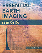
Essential Earth Imaging for GIS
Lawrence Fox III
A guide to imaging technology and management, Essential Earth Imaging for GIS discusses characteristics of images obtained from aircraft and spacecraft, and how to enhance, register, and visually interpret multispectral imagery and point clouds. Geographic information system (GIS) professionals can use this book to learn about basic imaging technology. Students can use this book as a reference for introductory GIS courses that include multispectral image display and analysis.
Available here.
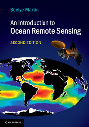
An Introduction to Ocean Remote Sensing
Seelye Martin
Fully updated, with significant new coverage of advances in satellite oceanography and results from new satellite missions, the second edition of this popular textbook introduces students to how remote sensing works, how to understand observations from Earth-observing systems, and the observations’ importance to physical and biological oceanography. It provides full explanations of radiative transfer, ocean surface properties, satellite orbits, instruments and methods, visible remote sensing of biogeochemical properties, infrared and microwave retrieval of sea surface temperature, sea surface salinity retrieval, passive microwave measurements, scatterometer wind retrieval, altimetry and SAR. Also included are descriptions of the online archives where data can be obtained, and readers can obtain online tools for working with the data – enabling hands-on engagement with real-world observations. This is an ideal textbook for graduate and advanced undergraduate students in oceanography, remote sensing and environmental science, and a practical resource for researchers and professionals working with oceanographic satellite data.
Available here.
Satellite InSAR Data: Reservoir Monitoring from Space
Alessandro Ferretti
Satellite radar data for surface deformation monitoring are gaining increasing attention, and not only within the oil and gas community. They provide a powerful tool for remotely measuring extremely small surface displacements over large areas and long periods of time, without requiring the installation of in-situ equipment. However, apart from remote sensing and radar specialists, only a relatively small number of geoscientists and engineers understand how a radar sensor orbiting the Earth at about 7 km/s from 700km above the Earth’s surface can actually measure ground displacements of a fraction of a centimetre. This book provides a step-by-step introduction to satellite radar sensors, SAR imagery, SAR interferometry and advanced InSAR techniques. Rather than a tutorial for remote sensing specialists, the book starts from very basic concepts and explains in plain language the most important ideas related to SAR data processing and why geoscientists and engineers should take a vested interest in this new information source.
Available here.
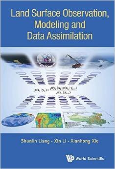
Land Surface Observation, Modeling and Data Assimilation
Shunlin Liang, Xin Li, and Xianhong Xie
This book is unique in its ambitious and comprehensive coverage of earth system land surface characterization, from observation and modeling to data assimilation, including recent developments in theory and techniques, and novel application cases. The contributing authors are active research scientists, and many of them are internationally known leading experts in their areas, ensuring that the text is authoritative.
This book comprises four parts that are logically connected from data, modeling, data assimilation integrating data and models to applications. Land data assimilation is the key focus of the book, which encompasses both theoretical and applied aspects with various novel methodologies and applications to the water cycle, carbon cycle, crop monitoring, and yield estimation.
Readers can benefit from a state-of-the-art presentation of the latest tools and their usage for understanding earth system processes. Discussions in the book present and stimulate new challenges and questions facing today’s earth science and modeling communities.
Readership: Graduate students and scientists in remote sensing, hydrology, ecology, environment and other earth sciences.
Available here.
Microwave Radar and Radiometric Remote Sensing
Fawwaz Ulaby, David Long
The 1000-page book covers theoretical models, system design and operation, and geoscientific applications of active and passive microwave remote sensing systems. It is designed as a textbook for a postgraduate course, as well as a reference for the practicing professional. To facilitate understanding and use of the material, the book includes 50 MATLAB-based computer codes and the book’s website includes interactive modules based on theoretical and empirical models. The book is a must-have for every scientist and engineer with interest in microwave remote sensing.
For international orders and more information on this book, please visit the Microwave Radar and Radiometric Remote Sensing Book Resource Website.
Available here.
Polarimetric Scattering and SAR Information Retrieval
Ya-Qui Jin and Feng Xu
Taking an innovative look at Synthetic Aperture Radar (SAR), this practical reference fully covers new developments in SAR and its various methodologies and enables readers to interpret SAR imageryAn essential reference on polarimetric Synthetic Aperture Radar (SAR), this book uses scattering theory and radiative transfer theory as a basis for its treatment of topics. It is organized to include theoretical scattering models and SAR data analysis techniques, and presents cutting-edge research on theoretical modelling of terrain surface. The book includes quantitative approaches for remote sensing, such as the analysis of the Mueller matrix solution of random media, mono-static and bistatic SAR image simulation. It also covers new parameters for unsupervised surface classification, DEM inversion, change detection from multi-temporal SAR images, reconstruction of building objects from multi-aspect SAR images, and polarimetric pulse echoes from multi-layering scatter media.
Structured to encourage methodical learning, earlier chapters cover core material, whilst later sections involve more advanced new topics which are important for researchers. The final chapter completes the book as a reference by covering SAR interferometry, a core topic in the remote sensing community.
- Features theoretical scattering models and SAR data analysis techniques
- Explains the simulation of SAR images for mono- and bi-static radars, covering both qualitative and quantitative information retrieval
- Chapter topics include: theoretical scattering models; SAR data analysis and processing techniques; and theoretical quantitative simulation reconstruction and inversion techniques
- Structured to enable both academic learning and independent study, laying down the foundations first of all before advancing to more complex topics
- Experienced author team presents mathematical derivations and figures so that they are easy for readers to understand
- Pitched at graduate-level students in electrical engineering, physics, earth and space sciences, as well as researchers
- MATLAB code available for readers to run their own routines
- An invaluable reference for research scientists, engineers and scientists working on polarimetric SAR hardware and software, Application developers of SAR and polarimetric SAR, remote sensing specialists working with SAR data – using ESA.
Available here.
Remote Sensing with Imaging Radar
J. A. RichardsThis book treats the technology of radar imaging for remote sensing applications in a manner suited to the mathematical background of most earth scientists. It assumes no prior knowledge of radar on the part of the reader; instead it commences with a development of the essential concepts of radar before progressing through to a detailed coverage of contemporary ideas such as polarimetry and interferometry.Because the technology of radar imaging is potentially complex the first chapter provides a framework against which the rest of the book is set. Together, the first four chapters present the technical foundations for remote sensing with imaging radar. Scattering concepts are then covered so that the reader develops the knowledge necessary for interpreting radar data, itself the topic of a later chapter which draws together the current thinking in the analysis of radar imagery.The treatment is based on the assumption that the radars of interest are, in general, multi-polarised. Polarisation synthesis and polarised interferometric SAR are among the topics covered, as are tomography and the various forms of interferometry. A full chapter is given to bistatic radar, which is now emerging as an imaging technology with enormous potential and flexibility in remote sensing. The book concludes with a summary of passive microwave imaging.A set of appendices is included that provide supplementary material, among which is an overview of the rather complicated process of image formation with synthetic aperture radar, and summaries of some of the mathematical procedures important for a full appreciation of radar as a remote sensing technology
Available here.
Statistics for Imaging, Optics, and Photonics
A vivid, hands-on discussion of the statistical methods in imaging, optics, and photonics applications
In the field of imaging science, there is a growing need for students and practitioners to be equipped with the necessary knowledge and tools to carry out quantitative analysis of data. Providing a self-contained approach that is not too heavily statistical in nature, Statistics for Imaging, Optics, and Photonics presents necessary analytical techniques in the context of real examples from various areas within the field, including remote sensing, color science, printing, and astronomy.
Bridging the gap between imaging, optics, photonics, and statistical data analysis, the author uniquely concentrates on statistical inference, providing a wide range of relevant methods. Brief introductions to key probabilistic terms are provided at the beginning of the book in order to present the notation used, followed by discussions on multivariate techniques such as:
- Linear regression models, vector and matrix algebra, and random vectors and matrices
- Multivariate statistical inference, including inferences about both mean vectors and covariance matrices
- Principal components analysis
- Canonical correlation analysis
- Discrimination and classification analysis for two or more populations and spatial smoothing
- Cluster analysis, including similarity and dissimilarity measures and hierarchical and nonhierarchical clustering methods
Intuitive and geometric understanding of concepts is emphasized, and all examples are relatively simple and include background explanations. Computational results and graphs are presented using the freely available R software, and can be replicated by using a variety of software packages. Throughout the book, problem sets and solutions contain partial numerical results, allowing readers to confirm the accuracy of their approach; and a related website features additional resources including the book’s datasets and figures.
Statistics for Imaging, Optics, and Photonics is an excellent book for courses on multivariate statistics for imaging science, optics, and photonics at the upper-undergraduate and graduate levels. The book also serves as a valuable reference for professionals working in imaging, optics, and photonics who carry out data analyses in their everyday work.
Available here.
Remote Sensing Image Processing
Authors:
Gustavo Camps-Valls
Devis Tuia
Luis Gómez-Chova
Sandra Jiménez
Jesús Malo
This book examines the processes that support earth observation, which can help to mitigate a variety of social and environmental issues, such as devastation caused by natural disasters. To attain such objectives, the remote sensing community has turned into a multidisciplinary field of science that embraces physics, signal theory, computer science, electronics and communications. All of the applications are tackled under specific formalisms from a machine learning and signal/image processing point of view, such as classification and clustering, regression and function approximation, data coding, restoration and enhancement, source unmixing, data fusion or feature selection and extraction. Read the full abstract.
Available here.
Optical Remote Sensing


Saurabh Prasad
Lori M. Bruce
Jocelyn Chanussot
Optical remote sensing involves acquisition and analysis of optical data – electromagnetic radiation captured by the sensing modality after reflecting off an area of interest on ground. Optical image acquisition modalities have come a long way – from gray-scale photogrammetric images to hyperspectral images. The advances in imaging hardware over recent decades have enabled availability of high spatial, spectral and temporal resolution imagery to the remote sensing analyst. These advances have created unique challenges for researchers in the remote sensing community working on algorithms for representation, exploitation and analysis of such data.
Early optical remote sensing systems relied on multispectral sensors, which are characterized by a small number of wide spectral bands. Although multispectral sensors are still employed by analysts, in recent years, the remote sensing community has seen a steady shift to hyperspectral sensors, which are characterized by hundreds of fine resolution co-registered spectral bands, as the dominant optical sensing technology. Such data has the potential to reveal the underlying phenomenology as described by spectral characteristics accurately. This “extension” from multispectral to hyperspectral imaging does not imply that the signal processing and exploitation techniques can be simply scaled up to accommodate the extra dimensions in the data. This book presents state-of-the-art signal processing and exploitation algorithms that address three key challenges within the context of modern optical remote sensing: (1) Representation and visualization of high dimensional data for efficient and reliable transmission, storage and interpretation; (2) Statistical pattern classification for robust land-cover-classification, target recognition and pixel unmixing; (3) Fusion of multi-sensor data to effectively exploit multiple sources of information for analysis.
Available here.
Image Registration for Remote Sensing
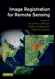

Jacqueline Le Moigne, NASA-Goddard Space Flight Center
Nathan S. Netanyahu, Bar-Ilan University, Israel and University of Maryland, College Park
Roger D. Eastman, Loyola University Maryland
Image registration is a digital processing discipline that studies how to bring two or more digital images into precise alignment for analysis and comparison. Accurate registration algorithms are essential for creating mosaics of satellite images and tracking changes on the planet’s surface over time. Bringing together invited contributions from 36 distinguished researchers, the book presents a detailed overview of current research and practice in the application of image registration to remote sensing imagery. Chapters cover the problem definition, theoretical issues in accuracy and efficiency, fundamental algorithms, and real-world case studies of image registration software applied to imagery from operational satellite systems. This book provides a comprehensive and practical overview for Earth and space scientists, presents image processing researchers with a summary of current research, and can be used for specialised graduate courses.
Available here.
Microwave Radiometer Systems: Design and Analysis, Second Edition

Niels Skou
David Le Vine
This practical reference covers radiometer receivers on a block diagram level, helping you determine whether to use direct- or super-heterodyne receivers and describing how to a combine double sideband or single sideband mixer operation with a microwave preamplifier. The book introduces the basic concept of aperture synthesis, explaining the benefits of using it for remote sensing. Moreover, you gain a thorough understanding of synthetic aperture radiometers and are provided with real-world examples, including the ESTAR and HYDROSTAR sensors. This comprehensive book also covers the relationships between swathwidth, footprint, integration time, sensitivity, and frequency for satellite born, real aperture imaging systems.
Available here.
Neural Networks in Atmospheric Remote Sensing

William J. Blackwell, MIT Lincoln Laboratory
Frederick W. Chen, Signal Systems Corporation
This authoritative reference offers you a comprehensive understanding of the underpinnings and practical applications of artificial neural networks and their use in the retrieval of geophysical parameters. You find expert guidance on the development and evaluation of neural network algorithms that process data from a new generation of hyperspectral sensors. The book provides clear explanations of the mathematical and physical foundations of remote sensing systems, including radiative transfer and propagation theory, sensor technologies, and inversion and estimation approaches. You discover how to use neural networks to approximate remote sensing inverse functions with emphasis on model selection, preprocessing, initialization, training, and performance evaluation.
Available here.
Statistical Image Processing and Multidimensional Modeling

Fieguth, Paul
Signal Theory Methods in Multispectral Remote Sensing

David A Landgrebe
An outgrowth of the author’s extensive experience teaching senior and graduate level students, this is both a thorough introduction and a solid professional reference.
Material covered has been developed based on a 35-year research program associated with such systems as the Landsat satellite program and later satellite and aircraft programs.
Covers existing aircraft and satellite programs and several future programs
An Instructor’s Manual presenting detailed solutions to all the problems in the book is available from the Wiley editorial department.
Available here.
Radiowave Propagation: Physics and Applications

Curt Levis
Joel T. Johnson
Fernando L. Teixeira
Propagation-the process whereby a signal is conveyed between transmitter and receiver-has a profound influence on communication systems design. Radiowave Propagationprovides an overview of the physical mechanisms that govern electromagnetic wave propagation in the Earth’s troposphere and ionosphere. Developed in conjunction with a graduate-level wave propagation course at The Ohio State University, this text offers a balance of physical and empirical models to provide basic physical insight as well as practical methods for system design.
Beginning with discussions of propagation media properties, plane waves, and antenna and system concepts, successive chapters consider the most important wave propagation mechanisms for frequencies ranging from LF up to the millimeter wave range, including:
- Direct line-of-sight propagation through the atmosphere
- Rain attenuation
- The basic theory of reflection and refraction at material interfaces and in the Earth’s atmosphere
- Reflection, refraction, and diffraction analysis in microwave link design for a specified terrain profile
- Empirical path loss models for point-to-point ground links
- Statistical fading models
- Standard techniques for prediction of ground wave propagation
- Ionospheric propagation, with emphasis on the skywave mechanism at MF and HF and on ionospheric perturbations for Earth-space links at VHF and higher frequencies
- A survey of other propagation mechanisms, including tropospheric scatter, meteor scatter, and propagation effects on GPS systems
Radiowave Propagation incorporates fundamental materials to help senior undergraduate and graduate engineering students review and strengthen electromagnetic physics skills as well as the most current empirical methods recommended by the International Telecommunication Union. This book can also serve as a valuable teaching and reference text for engineers working with wireless communication, radar, or remote sensing systems.
Available here.
Fundamentals of Satellite Remote Sensing

Emilio Chuvieco
Alfredo Huete
An extensive review of remote sensing principles with an emphasis on environmental applications, Fundamentals of Satellite Remote Sensing discusses a wide range of topics, from physical principles to data acquisition systems and on to visual and digital interpretation techniques. The text focuses on the interpretation and analysis of remote sensing images and how they improve our understanding of environmental processes and their interaction with human activities.
The authors discuss new interpretation approaches, including hyperspectral analysis, high-spatial resolution data, and radiative transfer models. The presentation includes an analysis of accuracy assessment methods and demonstrates how to integrate remote sensing results with geographic information systems. It also covers recent missions, such as Terra-Aqua, Envisat, Ikonos-Quickbird-Geoeye and SPOT-5, as well as LIDAR and interferometric radar.
The discussion of visual criteria to extract interpretation from satellite images emphasizes differences and similarities with conventional photo-interpretation techniques. A chapter on accuracy assessment and the connection between remote sensing and geographic information systems helps readers extend the interpretation of satellite images to a more operational, applications-oriented framework.
Available here.


