


Tuesday, September 22, 2020
4:00-4:20 PM Central European Time
Speakers:
Uta Heiden, DLR, Germany
Cindy Ong, CSIRO, Australia
Jens Nieke, ESR, Netherlands
Sponsored by GRSS
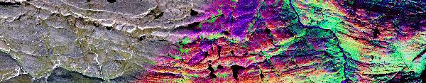
GRSS Geoscientific Spaceborne Imaging Spectroscopy (GSIS) TC: Running and planned spaceborne imaging spectroscopy missions and related activities
In this webinar we will first provide an overview of our past, ongoing, and future activities of the Geoscience Spaceborne Imaging Spectroscopy TC with the emphasis to enable people to shape and influence this network according to their needs. We will further inform about the currently running spaceborne imaging spectroscopy missions including data access and additionally, we inform about the unique sensor constellations of the International Space Station (ISS).
The GRSS Geoscience Spaceborne Imaging Spectroscopy (GSIS) technical committee provides a platform for all stakeholders engaged in spaceborne imaging spectroscopy with an emphasis on geoscientific applications.
The mission of the GSIS TC is to share information on future spaceborne imaging spectroscopy (“hyperspectral”) missions and to provide opportunities for new scientific and commercial partnerships. Relevant topics ranges from calibration / validation, mission interoperability, mass data management challenges and standardisation of data.
SPEAKER’S BIO:
 Uta Heiden received her Ph.D. from TU Berlin in 2004. She then joined DLR and since 2013 has been Head of the “Applied Spectroscopy Team” of the Land Surface Application Department at DLR-DFD where she works on the development of hyperspectral data products for landscape characterization and related topics. She is also chair of the IEEE Geoscience and Remote Sensing Society’s Geoscience Spaceborne Imaging Spectroscopy Technical Committee.
 Cindy Ong obtained a Mechanical Engineering degree with honours from the University of Western Australia. She practiced as a graduate engineer at BHP before making a career change taking up a remote sensing research position at the Department of Land Administration working on benthic habitat mapping. In 1994, Cindy was offered a research technician position at CSIRO focussed on mine environment and has since progressed from that to principal research scientist, concurrently acquiring a PhD degree from the Department of Imaging and Applied Physics, Curtin University. During this period, her research was pre-dominantly focused on monitoring environmental impacts related to non-renewable resource development including working on some of the mineral’s industry’s topical issues such as dust and acid mine drainage.
Between 2010 and 2014, Cindy served as the Research Group Leader of the Mineral And Environmental Spectral Sensing Group providing broad scientific leadership in a group of 25 scientists and engineers working across the value chain of imaging spectroscopy from sensor development, atmospheric physics, calibration and validation, information extraction and software development for applications across exploration, mining and mine environment deploying a variety of optical sensors from laboratory to airborne platforms.
Currently, Cindy’s prime research focus are on the quantification and monitoring of methane and other environmental impacts related to the onshore gas industry, and calibration and validation of optical earth observation sensors. She leads the Emissions Prevention, Monitoring and Response Test Bed in the Active Integrated Matter Future Science Platform. Additionally, she co-leads the pan-CSIRO project on optical calibration and validation where she is leading the effort to set up a new vicarious calibration site specifically for imaging spectroscopy aligned with the principles of RadCalNet.
Cindy is the Chair for the Committee on Earth Observation Satellites Working Group on Calibration and Validation. Cindy is the current chair of the IEEE Geoscience Remote Sensing Society Geoscience Spaceborne Imaging Spectroscopy Technical Committee where she leads the calibration and validation initiative. She is also a member of the science advisory group for Germany’s imaging spectroscopy satellite mission, EnMAP. She is a member of the mission advisory group of the European Space Agency’s candidate hyperspectral mission, CHIME. She is on the calibration and validation working group of NASA’s surface biology and geology mission. Cindy was involved in the development of and is a member the working group of the GEO Energy and Minerals Societal Benefit Area.
 Jens Nieke received the M.Eng. degree in aero- and astronautical engineering from the Technical University of Berlin, Berlin, Germany, and the National Institute of Applied Sciences, Lyon, France, and the Ph.D. degree on an advanced satellite mission study for regional coastal zone monitoring from the Technical University of Berlin, in 2001.
In 1995, he joined the Moderate Optoelectrical Scanner-Indian Remote Sensing satellite (MOS-IRS) Team, German Aerospace Center, Berlin, which launched a spaceborne imaging spectrometer in 1997. From 2000 to 2003, he was a Visiting Scientist with the Earth Observation Research Center, Japan Aerospace Exploration Agency, Tsukuba, Japan, where he was involved in the calibration and validation of the Advanced Earth Observing Satellite-II Global Imager mission. From 2004 to 2007, he was with the Remote Sensing Laboratories, University of Zurich, Zurich, Switzerland, as a Senior Scientist, Lecturer, and Project Manager of the Airborne Prism EXperiment project of the European Space Agency (ESA), Noordwijk, The Netherlands. Since 2007, he has been with the European Space Research and Technology Centre, ESA, where he is a member of the Sentinel-3 team.


