IEEE GRSS Hyperspectral Cal/Val Workshop
Edinburgh, UK
Oct 7-9, 2015
Participants
  | Cindy Ong Principal Research Scientist, Spectral Sensing Research Team Leader, Spectral Sensing Team Mineral Systems Science Group, Discovering Australia’s Mineral Resources Program Mineral Resources Flagship Australian Resources Research Centre 26 Dick Perry Ave, Kensington, Western Australia 6151 Australia Ph: +61-8-6436 8677 Fax: +61-8-6436 8586 Web: http:/www.csiro.au Email: Cindy.Ong@csiro.au Cindy is currently a Research Team Leader for the Spectral Sensing Team in the CSIRO Mineral Resources. Her graduate training was in Mechanical Engineer and her PhD was in Applied Physics. For the past 20 years, she has worked as a research scientist performing R&D on hyperspectral technology focused on delivering quantitative environmental measurements for the mining industry and natural resources management and regulatory requirements. More recently her work has extended to the extractive and agriculture industry. Her expertise are in calibration and validation (lab and vicarious), spectral libraries, standards, environmental regulations and environmental monitoring especially related to mining and extractive industry, ie, rehabilitation, dust, acid mine drainage, fugitive gas. |
  | Andreas Müller Head of Department German Aerospace Center (DLR) Earth Observation Center German Remote Sensing Data Center Land Surface Oberpfaffenhofen 82234 Weßling Germany Phone:+49 8153 28-1533 Fax:+49 8153 28-1458 Internet:www.dlr.de/eoc Email: Andreas.Mueller@dlr.de Andreas received his diploma at the Working-Group for Geo-Scientific Remote Sensing at Munich in geology and remote sensing in May 1990. He is now the head of the Working Group ‘Imaging Spectroscopy’ at the German Remote Sensing Data Center (DLR). His research interests include: Radiometric and spectral simulation of imaging spectrometers; Spectral characterisation of natural surfaces; and Application development focusing on: Land Degradation, Mining Environments. |
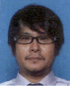 | Hirokazu Yamamoto Senior Research Scientist Geological Survey of Japan/ AIST The Institute of Geology and Geoinformation Remote Sensing Research Group Central 7, Higashi 1-1-1, Tsukuba, Ibaraki 305-8567 Japan Phone: +81-29-861-3956 Internet: unit.aist.go.jp/igg/rs-rg/eng_index.html Email: hirokazu.yamamoto@aist.go.jp Hirokazu Yamamoto received the B.Sci. degree from Faculty of Education, Waseda University in 1995, and the M.Eng. degree from Image Science and Technology, Chiba University in 1997., and Ph.D. degrees in Electronics and Photonic Systems from Chiba University in 2000. He is currently a researcher at Geological Survey of Japan, National Institute of Advanced Industrial Science and Technology. His research interests include the calibration and validation of optical satellite sensors. |
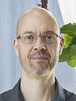  | Jeffrey S. Czapla-Myers Associate Research Professor of Optical Sciences College of Optical Sciences The University of Arizona 1630 E. University Blvd., Meinel 602 P.O. Box 210094 Tucson, AZ 85721-0094 Phone: 520-621-4242 Email: jscm@optics.arizona.edu Jeff received his PhD from the University of Arizona in 2006. His research interests include: ground-based radiometric calibration of airborne and spaceborne remote sensing systems; development of automated methodology, test site and instrumentation for vicarious calibration of remote sensing systems; radiometric instrumentation design; and uncertainty analysis of earth science data products. |
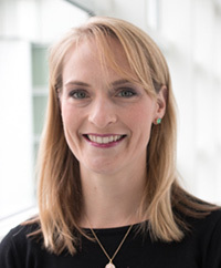  | Joanne Nightingale Principal Research Scientist in Earth Observation and Climate National Physical Laboratory Hampton Road, Teddington, Middlesex, TW11 0LW United Kingdom Tel: 020 8943 6722 Email: joanne.nightingale@npl.co.uk Dr Joanne Nightingale joined NPL in 2013 from NASA’s Goddard Space Flight Center and brings over six years’ experience in coordinating Earth Observation System global land product and essential climate variable (ECV) validation activities. Joanne chaired the CEOS Working Group on Calibration and Validation, sub-group for Land Product Validation from 2010-2013. She obtained her PhD in Geography and Remote Sensing from the University of Queensland, Australia. Joanne’s research interests include: assessing the quality of information about forests derived from in situ measurement devices and Earth Observation Satellites; improving global satellite-derived biophysical product validation strategies; and contributing to good practice guidance for the evaluation of ECV data records. |
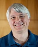  | Leland E. Pierce Associate Research Scientist Dept of Electrical Engineering and Computer Science 3214 EECS Bldg The University of Michigan Ann Arbor, Michigan 48109-2122 USA Phone: (734) 763-3157 Email: lep@umich.edu Leland received his PhD from the the Univ of Michigan in 1991. His recent research interests include: development of image processing techniques for radar remote sensing; scattering models for natural targets; and standards for remote sensing data and processing. |
  | Tim Malthus Research Group Leader Coastal Monitoring, Modelling and Informatics Group Coastal Management and Development Program CSIRO Oceans and Atmosphere Flagship Dutton Park, Queensland Australia Tel: +61 2 6246 5732 Email: Tim.Malthus@csiro.au Tim received his PhD from the University of Otago, New Zealand in 1986. He previously led the Environmental Earth Observation Program in the CSIRO Division of Land and Water. He combines skills in calibration, validation and field spectroscopy with analysis of airborne and satellite Earth observation data, to develop improved monitoring tools for the management of land and water resources informing wider environmental policies. Tim’s research career has focused on earth observation of both the aquatic and terrestrial environments. Prior to joining CSIRO, Dr Malthus was Senior Lecturer in Remote Sensing, University of Edinburgh and Director of the Natural Environment Research Council (NERC) Field Spectroscopy Facility based at the University. |
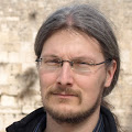  | Martin Bachmann German Aerospace Center (DLR) Earth Observation Center German Remote Sensing Data Center Land Surface Oberpfaffenhofen 82234 Weßling Germany Phone:+49 8153 28-3325 Fax:+49 8153 28-1458 Internet:www.dlr.de/eoc Email: martin.bachmann@dlr.de He received his PhD from the Univeristy of Würzburg in 2007. Martin is a Research Scientist at DLR-DFD, in the Working Group ‘Imaging Spectroscopy’. His research Interests include: automated pre-processing of remote sensing data; automated spectral unmixing; field and laboratory spectroscopy; and image fusion. He has more than 10 years of experience in the fields of hyperspectral data analysis and data pre-processing (system correction, ortho-rectification, atmospheric correction, spectral unmixing). He also has expertise in Data Quality Control for imaging spectrometer data. Coordinated and participated in multiple ground campaigns for validation / calibration of airborne hyperspectral data (inc. CEOS CalVal activities). |
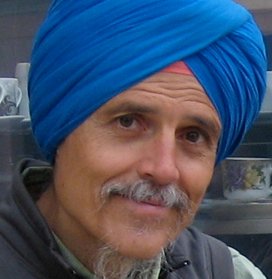  | Siri Jodha Singh Khalsa Research Scientist III National Snow and Ice Data Center CIRES, 449 UCB University of Colorado Boulder, CO 80309-0449 USA Phone: 303-492-1445 Email: sjsk@nsidc.org He received his Phd from the University of Washington in 1978. His specialties include: remote sensing and geographic information systems; client interface and metadata; data tool development; and algorithm support. |
  | Stefanie Holzwarth German Aerospace Center (DLR) Earth Observation Center German Remote Sensing Data Center Land Surface Oberpfaffenhofen 82234 Weßling Germany Phone:+49 8153 28-3368 Fax:+49 8153 28-1458 Stefanie.Holzwarth@dlr.de Stefanie is a researcher at DLR who has been working on the EUFAR project for the past several years, including standards for airborne hyperspectral image data. |
  | Christopher J. MacLellan Research Associate in Field Spectroscopy NERC Field Spectroscopy Facility School of Geosciences The University of Edinburgh James Hutton Road, Edinburgh EH9 3FE UK Phone: +44 (0) 131 650 8596 FAX: +44 (0) 131 650 5901 Email: Chris.MacLellan@ed.ac.uk He received the B.Sc. degree in physics from the University of Edinburgh, Edinburgh, U.K., in 1981. He has worked in industry where he specialized in the design, manufacture, and calibration of light measurement instrumentation with Macam Photometrics Ltd, Livingston, U.K., and Optronic Laboratories Inc., Orlando, FL. He is currently the Equipment Manager with the Natural Environment Research Council, Field Spectroscopy Facility, School of Geosciences, University of Edinburgh, where his responsibilities include equipment test and calibration, system performance measurements, and new sensor design. |
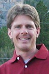  | Kurt Thome NASA/Goddard Space Flight Center Biospheric Sciences Laboratory Mail Code: 618 Greenbelt, MD 20771 USA Phone: 301.614.6671 Email: kurtis.thome@nasa.gov Kurt Thome obtained a BS degree in Meteorology from Texas A&M University and MS and PhD degrees in Atmospheric Sciences from the University of Arizona. He then joined what is now the College of Optical Sciences becoming full professor in 2006. He served as the Director of the Remote Sensing Group from 1997 to 2008. Thome moved to NASA’s Goddard Space Flight Center in 2008 as a Physical Scientist in the Biospheric Sciences Branch. He was been a member of the Landsat-7, ASTER, MODIS, and EO-1 Science Teams providing vicarious calibration results for those and other imaging sensors. Thome also served on the Global Aerosol Project Team and the Landsat Calibration Team. Thome was selected as a Fellow of SPIE in 2006 and served as the calibration lead for the Thermal Infrared Sensor on the Landsat Data Continuity Mission from 2009-2013. |


